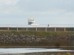
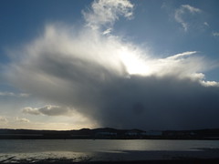
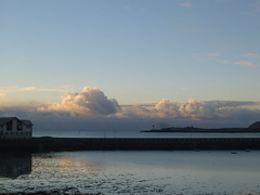
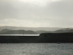
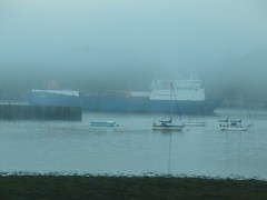
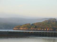
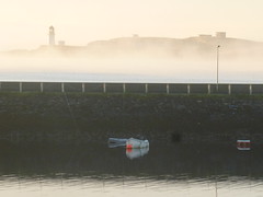
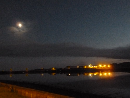
View across the Outer Harbour of Stornoway

Monday, 29 October 2012

Monday 29 October

Another overcast day with occasional rain. There was not much wind, and not very warm - we only managed 7C / 45F. Went to get seed for the birdfeeders, now that the leaves are off the trees. The starlings, sparrows and collared doves were quick to take advantage of the feeding.

I have kept a close eye on hurricane Sandy, and I only need to refer to media coverage. The NHC made a mistake with its 5pm EDT advisory, overwriting it with the 11am advisory. I had to email them, and (with others emailing them as well) they quickly rectified the error. I hope nobody will be hurt as a result of Sandy; we but live in hope.

This morning, I noticed a heavy lift vessel Atlantic docked at the Arnish Fabrication Yard. These vessels tend to come here to uplift ready made items for the renewables industry.


PA299268 PA299272

Sunday, 28 October 2012

Home is the island

Distant shapes on the eastern horizon
The mainland hills, rarely well defined
Far-off mountains beckoning
Sometimes speaking of winter's cold

Alluring to some, in search of great riches
Seeking a better life beyond their range
The lights of the big city
Moving fast, gaining the high life

Dashing up the social ladder
The comforts of a well-filled purse
Poverty, though, is not just monetary
And fair-weather does not filter your friends

But even when all seems so good
One thing though is missing
It'll always be there, on the western horizon
With the lighthouse beaming its call at dusk

As the ferry leaves Loch Broom behind
And Sutherland's mountains recede in the distance
Tiumpan and Arnish winking their welcome
As the boat glides towards the pier

Familiar faces and familiar buildings
The quiet streets in the dim streetlamps' light
The dark roads beyond town but comforting
Home at last, and here to stay

Sunday 28 October

A wet start to the day, with a dry intermission during the afternoon, leaving us with more rain by nightfall. And nightfall occurred well before 5pm, the clocks having gone back last night. The ferry departed for its customary Sunday crossing at 9 am, rather than 2.30pm. This change in schedule had not really been advertised, leaving some people to turn up at the usual time - only to find they had missed the boat. Some could catch the plane to Inverness, but that was soon full up. And it was 10 years ago that Sunday flights commenced here.

I have been keeping an eye on hurricane Sandy, which is going to be a nightmare for the mid-Atlantic states in the US. At least two of my blogging friends appear to be in the path of the storm, and very likely several others are as well. I'll monitor this through my tropical cyclones blog, but please consult the NHC and HPC site for three-hourly updates - if not more frequent once Sandy comes ashore. Also a cause for concern is category II typhoon Son-tinh, which is headed for Hanoi in Vietnam.

If you're in the path of Sandy, stay safe and follow all official directives. 

PA289263 PA289262 PA289260 PA289255 PA289252 PA289250


Hurricane!

Overhead in the sky beating down
the sun radiates its immeasurable heat
absorbed by the waters of this world
gradually warming - east to west

Cloudless skies show countless suns
at an inconceivable distance
reaching there would be
after the end of this planet

Rising from the surface of the ocean
evaporated water, using
some of the sun's heat to escape
higher up into the sky

Reverting back to liquid
releasing the energy again
Towering nearly a dozen miles up
A shard of lightning leaves a trail of thunder

As our world turns, so do the storms
Winds being to blow, higher
The eye up above espies
the signal given - formation alert

The heat from the water now channels
right to the top of the clouds
which have cooled in sharp contrast
Turbulence rises, a storm is born

Dark clouds arrive
over the tropical horizon
Limpid heat blown away
in amazing fury

Rain lashes horizontally
Trees bend if not snap
Hunker down, seek shelter
It's over!

Not so
A calm of an hour
Distant roaring amidst
the deceptive sunshine

Opposing winds resume
their path of destruction
until it has passed
leaving but wreckage

The balance is restored
Heat is transferred to the pole of the earth
Through the winds of the cyclone
The safety valve has worked - equilibrium rules

Hurricane update - 28 October

Hurricane Sandy continues to pose a major threat to the east coast of the USA, from the Carolinas northward. I refer to the NHC for 3-hourly updates. A few notable stats out of the latest advisory.

Hurricane force winds extend for 175 miles from the centre, which is an extremely large radius
Tropical storm force winds (i.e. winds of galeforce or higher) extend for 520 miles from the centre, again an extremely wide radius

Current lowest pressure in the centre is 951 mbar, very low for a system that "only" carries hurricaneforce winds of 75 mph.

Storm surge flooding of 6 to 11 feet is expected around New York

Rainfall totals will add up to 12 inches in places.

Saturday, 27 October 2012

A wet day

Hueless grey drapes across the skies
Uniform in colour, or lack of it
The sun, wan and without warmth,
peeps through the veil a final time

A single drop falls on the ground
followed by countless more
the window soon is streaming
if there was light, the wet road would shine

Darkness comes in well before
the sun heads towards dusk
Lights come on, although it's daytime
Cheerless gloom slowly moves up from the east

The yellow glare of the street lanterns
is softened by the glow of light
reflected by the falling rain
closed out by drawn curtains

A fire dully flickers in the hearth
born of sunshine from when the earth was young
chases the chill of a rainy day
away out and up the chimney

Saturday 27 October

An overcast day which turned very wet by the afternoon. The cold weather relented a bit, with the mercury gradually rising to 9C / 48F. We shall have more rain tomorrow, but the wind will pick up in the second half of the afternoon. The ferry has been retimed its Sunday sailing from 2.30pm to 9am in order to 'beat' the wind and, more to the point, the northerly swell.

It is ten years ago that flights to Stornoway were started on Sundays. It was the beginning of the end, as some would see it, for the Lewis Sunday. I don't believe so. Not much has changed over the 3 years since the Sunday ferry started, and I do not expect hordes of vehicles thronging to the quayside tomorrow morning. The Sunday crossing is in fact the busiest of the week, and helps families to be together over weekends. I don't expect shops to open on Sundays any time soon, nor buses to run on Sunday either.

I hope that hurricane Sandy will not have too severe an impact on the USA. As things stand, the storm will come ashore after the weekend in the middle of the most densely part of the States.

Hurricane update - 27 October

Hurricane Sandy is a major cause for concern along the eastern seaboard of the USA, from Florida all the way to Rhode Island. The storm will broadly maintain hurricane intensity, but carries a windfield of galeforce or higher of no less than 450 miles across.

The hazards accompanying Sandy are threefold.
1. High winds. These are liable to blow down trees (still in full leaf), taking powerlines with them, and damaging houses and other property

2. Storm surge. This is currently forecast at 4 to 8 feet from Ocean City MD as far north as the CT / RI border, which includes New York City.

3. Rainfall. At present, totals of 4 to 8 inches, locally up to 12 inches across parts of the mid-Atlantic states is forecast. This presents the risk of surface and fresh-water flooding.

The NHC carries 3-hourly updates.
The NWS will carry advisories for your locality.

Typhoon Son-tinh is currently south of Hainan Island and bearing down on the coast of northern Vietnam with central winds of 110 knots (125 mph) which will only decrease slightly to 95 knots (110 mph) at landfall. The same hazards apply to this system as outlined with Sandy, but to a higher degree - Son-tinh is equivalent to a category III hurricane. 

Friday, 26 October 2012

Friday 26 October - picture post

PA269237 PA269236 PA269234 PA269233 PA269224 PA269221

Friday 26 October

A very cold day, with the mercury barely at 5C / 41F, and flurries of snow in the morning. As the sun attempted to warm things up, these turned to hail and finally ceased after lunchtime. At time of posting (10pm), there is heavy snow in the northeast of Scotland, with hazardous driving conditions reported from the area around Braemar.The highlevel route over the Clisham, in North Harris, was also quoted as being under a thin layer of snow.

The east coast of the USA is preparing itself for the arrival of hurricane or tropical storm Sandy, which is presently leaving the Bahamas. It is feared that the storm could bring winds of 70 mph and around 6 inches of rainfall - damage of $1bn is anticipated.

So, you have this old tin of rabbit poison. If this comes in touch with moisture, it will release cyanide gas and that could kill you. How do you get rid of it? Contact a depot and they advise you to wrap it in plastic and send it off to them. Let's vacuum wrap it and then it's all secure. Hitch up the vacuum cleaner hose to the plastic bag containing the tin. Woops, the vacuum draws out the powder from the cracked lid and blows it right into the room you're in! The rest, as they say, is history.

Warning of winter

The last leaves gently float down from the trees
Their dried out husks rustle along the ground
in the cold autumn wind, gathering up
in sheltered corners

Proud stand the clouds, with their white crowns
Robes of white and grey flowing
Rain? No, hail and snow, bitterly cold
The north wind carries a deep bite

Slush in secluded corners from
forgotten hailstones, which have omitted
to melt and will freeze
after the setting of the wan sun

A ribbon of black slopes gradually up
angling over the broad shoulders
of the dark grey mountains
No slush here, just a layer of snow

Go carefully, follow the tracks
if not already filled in by new snow
Here where it's high up, winter has come
But it's yet shy of the seashore

Up by the tops, wearing a trial bonnet
of unwashed white
the winds howl unimpeded
shouting an early warning

Come morning, autumn will have returned
No whites, just dark greens, browns and greys
But for how long?
Until winter truly comes.

Thursday, 25 October 2012

Thursday 25 October

Last night, someone at Uig Lodge in Timsgarry (some 35 miles west of here) decided to get rid of some old rabbit poison (containing cyanide), but got into contact with the stuff. He was driven towards town, but was intercepted by the emergency services, who set up a mobile decontamination unit in the middle of the road between Achmore and Leurbost, forcing traffic to divert along the Pentland Road. Fortunately, nobody was hurt.

Today saw a transition to markedly colder weather. Although we have the sun back, the moderate northerly wind made the 7C / 45F we had on the thermometer today made it feel a lot colder.

Down in the Caribbean, hurricane Sandy claimed two lives (one in Jamaica, another in Cuba) as it strengthened on passing over both islands. Maximum sustained winds are at 105 mph. The storm will now weaken, but still be a hurricane as it bears down on the Mid Atlantic states and New England in the USA. Oops.

Today's poem (Bridge to Bosta) is a reference to a true story associated with Great Bernera. I wrote it in cooperation with the lady's family, and have their permission to publish the photograph on the entry on this blog. The pic is also shown on my Facebook feed (which has restricted access), but not on the Facebook page on which I publish the poems.

PA259220 PA259212 PA259216

The bridge to Bosta

Two planks across the rowing boat
A motor car perched precariously
The ferryman rows ponderously
Across the narrow strait with fast flowing water

To work she came, the new nurse for Bernera
Only just on the island an urgent call came
To the house by little Tobson
A young lad lay drowned, claimed by the sea

To no avail did she work to bring him to life
The spirit of life was long gone
A sadness enveloped that house
Close by the double beach

Four times they have tried now
Ever foiled by the tidal currents
Will it work this time round
To drive the bridge’s pillars into the seabed?

The bridge is in place, its engineer proud
The ferryman’s out of a job
Cross the narrows to the Tir Mor
With dry feet and no fear of water

The bridge engineer took the nurse as his wife
And took her far far away
Over the bridge to Tir Mor
And beyond the shores of this land

Never would she reside there again
However much she yearned to one day
Cast her gaze over the wild beach at Bosta
And once more call it home

From the Southern Cross to North Star
Was her last journey beyond this life
The road ended at Bosta
Where now her spirit remains

In memory of Peggy Macleod, 1927-1989

Tir Mor is the local name for the area of “mainland” Lewis south of the Bernera Bridge, containing the villages of Lundale, Crulivig and Earshader.

Hurricane update - 25 October

Hurricane Sandy is leaving Cuba behind, having dumped more than 3 inches of rain in parts of the island. The storm passed directly over Santiago de Cuba at 0400 GMT today (8 hours ago at time of posting), with barometric pressure at 960 mbar, the official reading also quoted by the NHC. The Cuban weather service shows winds of 140 km/h (just below 90 mph) at Cabo Lucrecia, 60 miles north northwest of Guantanamo Bay.

Sandy will now proceed north to the Bahamas, which are on warning for a storm surge of 5 to 8 feet (1.5 to 2.4 metres) above normal tidal levels. The 90 mph winds at Cabo Lucrecia suggest the storm has not weakened and could reintensify further en-route to the Bahamas.

The US state of Florida could get a side-swipe from Sandy as it passes 100 to 200 miles to its east.

Three-hourly updates through the NHC.

Wednesday, 24 October 2012

Hurricane update - 24 October

Hurricane Sandy passed within 5 miles of Kingston, Jamaica, at 1900 GMT today. Winds of 80 mph occurred in the vicinity of the centre, and the storm will maintain that strength during the 200 mile crossing to Cuba. Having weakened due to the effects of land, Sandy will then reintensify over the Bahamas before transforming into a non-tropical depression. Whether this will affect the US east coast is as yet uncertain.

Tropical storm Son-tinh is passing through the Philippine islands, but once clear of those landmasses will balloon into a typhoon with winds of 90 mph. This system will continue on its present northwesterly course, and will make landfall near Hanoi, Vietnam, in 4 days' time.

Tropical cyclone 01A has formed east of the Horn of Africa, and will make landfall there tomorrow with winds of 55 mph. The rain that this storm brings will be most welcome in the Somali desert around there.

Wednesday 24 October

Overcast with only a few chinks of brightness amongst the clouds. Consequently, no nice cloudscapes, just drab, grey ones. So therefore not dozens of pics of them today. Tomorrow should be better, but a lot colder than the 11C we had today.

At the moment, hurricane Sandy is blasting across Jamaica, with its capital, Kingston, taking a close-up view of the storm. The system will continue north towards eastern Cuba, the Bahamas with the southeast of Florida getting a side-swipe. There is debate among forecasters what will happen once Sandy transforms into a "normal" depression; it is feared that it could head north and strafe the US east coast with force 11 winds.

The annual poppy appeal has been launched, to coincide with the 94th anniversary of the 1918 Armistice. This year, November 11th will fall on a Sunday, making it a true Remembrance Sunday. I am continuing with my compilation of information on the WW1 casualties from this island; the work is not complete (I'm about halfway); and even after I have completed my look-ups, there is still more information that could be added. I have suggested in certain quarters that the Roll of Honour for this island could be republished, but I don't know if that will be taken up. The original Roll, published in 1921, is not free of errors and oversights, but would take a monumental effort to revise, requiring input from the various historical societies in Lewis. The problem there lies in money and manpower. I would think that a small share of the £50m allocated to the WW1 centenary in 2014 by PM David Cameron might be helpful. However, that's not for me to decide.

Bosta

Deep blue seas hurrying through
a narrow channel to the next island
None left there as permanent residents
Only the markers to those gone before

The village in the sand was stirred
by violent winds from the present age
what did it look like, they wanted to know
only guesswork

Yielding an edifice that's stood
the test of time, but failed the one of modernity
Above the sands and past the river
None now live there, others come admiring

A dark storm looms from the northwest
The islands fade in the squalls of winter
Reappearing in blinding clearances
in a white wreath of flying foam

From small to larger the people were moved
To the township southeast, round the minister's manse
Further southeast more ancient a temple
Not to the sun but for observing the moon

Long gone have the people who erected the stones
Long gone are those driven away
At the whim of a minion, not caring
but for his master's pocket

Only the beach now remains
With the islands beyond
And the memory of those gone before
At Bosta

Tuesday, 23 October 2012

Hurricane update - 23 October

Tropical storm Sandy formed yesterday and is now moving north towards Jamaica. At present, the system is still 260 miles to the south of that Caribbean island, but will reach it tomorrow at hurricane force, with winds in excess of 75 mph. After traversing Jamaica, it will be the turn of eastern Cuba, parts of which are (with Jamaica) on a hurricane warning. Sandy will then move over the Bahamas, which will see the storm below hurricane force, but there is not much difference between winds of 70 and 60 knots.

Tropical depression 24W (locally named Ofel) has formed to the southeast of Manila in the Philippines. The system will reach tropical storm strength as it passes just north of Mindanao, through the Visayas and past southern Luzon. Although the winds do not appear to be much of a problem, rain will be. The mountainous terrain of the Philippine islands tends to lead to flash floods and mud slides which are life-threatening.

Somalia should be keeping an eye on a tropical disturbance (95B) which is slipping across the Arabian Sea from southern India and has a high (> 50%) likelihood of becoming a tropical cyclone. If it does, it is likely to die a death over Cape Guardafui (also known as the Horn of Africa) which is a desert area. Like in the adjacent Arabian peninsula, tropical cyclones tend to be welcome in northeast Africa for the rain they bring. 

Tuesday 23 October - picture post


PA239160 PA239164 PA239167 PA239173 PA239175 PA239182 PA239189 PA239193

Tuesday 23 October

The day started off quite foggy, but this lifted after sunrise, 8.30 am. Afterwards, it stayed bright and sunny right throughout the day. Even when darkness fell, there was hardly a cloud in the sky.

Over on the mainland, an accident closed the road between Inverness and Ullapool, from where the ferry to Stornoway sails. This resulted in delays to traffic seeking to catch the 5.35pm ferry. Calmac showed consideration by delaying this sailing until 8.30pm. It is now due in at 11.15pm. Three hours late, but better late than not until next morning.

I omitted to mention that last week saw the 120th edition of the Royal National Mod in Dunoon. At that event, the schools in the Western Isles did very well, scooping up several awards. The 2016 Mod will be held here in Stornoway, after visits to Paisley next year, Inverness in 2014 and Oban in 2015. It is a showcase for Gaelic culture, not just singing or music. The Mod programme also includes shinty matches and readings of prose. As far as the singing goes, marks are not only awarded for the musical qualities, but also Gaelic pronounciation.

Gaelic is a language that is only a distant relation to English, but several Gaelic words have crept into common usage in English. The word galore (gu leoir) is the best-known example. I do not speak Gaelic, and only know a handful of words. I am familiar though with the Gaelic version of placenames in Lewis and Harris. Although these may appear like a bad bout of alphabet soup (e.g. Gearraidh na h-Aibhne), if you know the rules on pronounciation and can manage the guttural CH (as in LOCH) you'll do fine. To me, the Gaelic names make more sense than the Anglicised versions.