The weather today changed from bright and sunny in the morning to wet and windy just now, just after 6pm. Autumn has definitely arrived. I spent the afternoon salvaging a blog that was hosted on the website of a Dutch national newspaper. They axed their blogging service last week, and promised that a transfer to another service would be provided as of August 23rd. We are now 9 days down the line and nothing has happened. I was supposed to open a new account with the other providers - but the transfer has run into difficulties. So I've taken matters into my own hand and reconstructed the blog from Google's cache. I managed to retrieve virtually all the posts (yay!), but did get a deja-vu sensation - remember AOHell, 3 years ago?
In a few days' time, I shall meet fellow researcher Direcleit in person, after his move to Berneray this summer. He has secured a position as researcher for that island's historical society, with an extended remit to the Sound and Island of Harris. I am quite happy to continue my activities free-lance and on a voluntary basis, and am looking forward to comparing notes over a cuppa.
Thursday, 1 September 2011


Wednesday, 31 August 2011
Wednesday 31 August
The last day of the meteorological summer, and apart from the odd afternoon shower, it wasn't a bad day. Neither was it a particularly brilliant day, as we had to do without the sun.
We have a large gas storage tank which would flatten large areas of the town if it decided to explode. So, if there is ever any real trouble, they set off an alarm. Yesterday, they tried it out. We knew it would be trialled between 10 and 11 in the morning. Did I hear it? Nope. Had to open the window to make sure I could hear it. Oh well, if ever I suddenly have a clear view of the ruins of Stornoway, I know what has happened.
I spent the afternoon completing the transcriptions of WW2 tributes from 1941, sticking them on the Tribute blog and linking everything together. Next stop: 1942.
We have a large gas storage tank which would flatten large areas of the town if it decided to explode. So, if there is ever any real trouble, they set off an alarm. Yesterday, they tried it out. We knew it would be trialled between 10 and 11 in the morning. Did I hear it? Nope. Had to open the window to make sure I could hear it. Oh well, if ever I suddenly have a clear view of the ruins of Stornoway, I know what has happened.
I spent the afternoon completing the transcriptions of WW2 tributes from 1941, sticking them on the Tribute blog and linking everything together. Next stop: 1942.
Tuesday, 30 August 2011
Tuesday 30 August
An overcast day, but no rain or high winds. Summer is slowly drawing to a close here. I got myself more stamps for the Postcrossing project today, and 6 cards are winging their way to various parts of the globe.
I also visited the library to revisit the Stornoway Gazette of 1941. I take pictures of articles that I then transcribe; but the resulting pics are not always in focus. Some of the articles are quite interesting, although always very sad - bearing in mind it is tributes to the dead of the Second World War that I am interested in. One man died when his tugboat was blown up by a bomb. That happened a lot, but this occurred in a dock in Glasgow. During the Clydeside blitz of 1941, a bomb had plunged into a dock, but not exploded. It decided to detonate just when a tugboat was over it. This was literally blown out of the water. One man saved himself by shinning up the mast as quickly as the boat went down, and he was saved the moment he reached the top of the mast. Instrumental in the rescue of many crewmen were "coloured seamen" from a nearby merchant ship.
I think that the name Irene will be withdrawn by the WMO (World Meteorological Organisation) from the lists of Atlantic tropical cyclones. Although Irene did not carry extreme winds, she did carry extreme amounts of rain. After being downgraded from hurricane to tropical storm, the water that had powered the cyclone came down to earth with a vengeance. The imagery from New England is breathtaking - in the negative sense of the word.
I also visited the library to revisit the Stornoway Gazette of 1941. I take pictures of articles that I then transcribe; but the resulting pics are not always in focus. Some of the articles are quite interesting, although always very sad - bearing in mind it is tributes to the dead of the Second World War that I am interested in. One man died when his tugboat was blown up by a bomb. That happened a lot, but this occurred in a dock in Glasgow. During the Clydeside blitz of 1941, a bomb had plunged into a dock, but not exploded. It decided to detonate just when a tugboat was over it. This was literally blown out of the water. One man saved himself by shinning up the mast as quickly as the boat went down, and he was saved the moment he reached the top of the mast. Instrumental in the rescue of many crewmen were "coloured seamen" from a nearby merchant ship.
I think that the name Irene will be withdrawn by the WMO (World Meteorological Organisation) from the lists of Atlantic tropical cyclones. Although Irene did not carry extreme winds, she did carry extreme amounts of rain. After being downgraded from hurricane to tropical storm, the water that had powered the cyclone came down to earth with a vengeance. The imagery from New England is breathtaking - in the negative sense of the word.
Monday, 29 August 2011
Monday 29 August
Although the day started fairly bright, we were plagued by showers through the afternoon. And we have lost our "summer warmth": only 13C today. The ferry had to cancel its return crossing from Ullapool yesterday, and did not return until lunchtime today. There was a large amount of traffic to catch up on, and this evening it was an hour late coming back to Stornoway.
I have recorded all 26 episodes of The World at War, but I can only watch one episode at a time - too depressing. However, it is the best documentary on the Second World War, a topic I take an active interest in. Today, I transcribed more of the tributes from the Stornoway Gazette from 1941 to islanders who fell in that conflict.
I have recorded all 26 episodes of The World at War, but I can only watch one episode at a time - too depressing. However, it is the best documentary on the Second World War, a topic I take an active interest in. Today, I transcribed more of the tributes from the Stornoway Gazette from 1941 to islanders who fell in that conflict.
St Kilda
It is 81 years ago today that the last inhabitants of St Kilda were evacuated from their isle, situated 40 miles west of North Uist in the Outer Hebrides. Life had become untenable, when supplies could only be landed during the summer months. The islanders were also susceptible to illnesses, brought ashore by visitors. Until the late 19th century, there was a very high infant mortality rate, attributed to poor hygiene practices around newborns.
On 29 August 1930, the islanders of Hiort were taken to Lochaline, in the Morvern peninsula, and then on to Glasgow. Some stayed on at Lochaline, to work in forestry - an irony, coming as they did from a treeless island. The island has remained without permanent habitation. Some of the houses were left with a pile of grain on the table and the family Bible open at the book of Exodus.
I have only seen St Kilda from North Uist, on a clear day in summer. It is supposed to be visible from Mangersta, but the distance is 60 miles. The culture of the island was taken away by its people in 1930, and has been recorded assiduously. This may now be congregated at the St Kilda Centre, pencilled for a location between Mangersta and Islivig. It has been argued that a more sympathetic approach from central government in the early 20th century could have saved St Kilda for habitation. Maybe so. But it would have destroyed the unique culture, which came about through its sheer isolation.
Today, my thoughts lie 90 miles to the westsouthwest of Stornoway. The Hiorteachs have gone - their island remains.
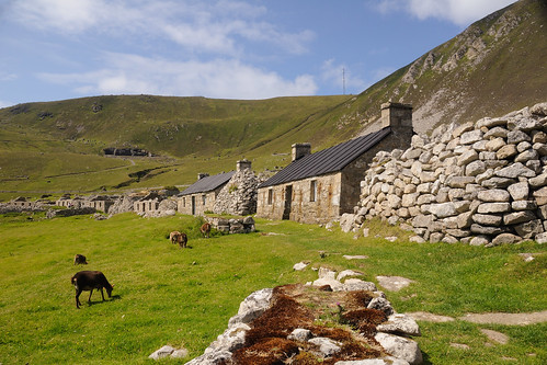
Image courtesy Flickr-user iancowe
On 29 August 1930, the islanders of Hiort were taken to Lochaline, in the Morvern peninsula, and then on to Glasgow. Some stayed on at Lochaline, to work in forestry - an irony, coming as they did from a treeless island. The island has remained without permanent habitation. Some of the houses were left with a pile of grain on the table and the family Bible open at the book of Exodus.
I have only seen St Kilda from North Uist, on a clear day in summer. It is supposed to be visible from Mangersta, but the distance is 60 miles. The culture of the island was taken away by its people in 1930, and has been recorded assiduously. This may now be congregated at the St Kilda Centre, pencilled for a location between Mangersta and Islivig. It has been argued that a more sympathetic approach from central government in the early 20th century could have saved St Kilda for habitation. Maybe so. But it would have destroyed the unique culture, which came about through its sheer isolation.
Today, my thoughts lie 90 miles to the westsouthwest of Stornoway. The Hiorteachs have gone - their island remains.
Image courtesy Flickr-user iancowe
Sunday, 28 August 2011
Libya and Lockerbie
Libya's ousted dictator, Muammar Gaddafi, has indicated to the rebels that he wants to talk about forming a new government. I don't think he's quite grasping the state of affairs in his country. He is out, and will never be able to come back in any capacity. This evening's film footage of charred corpses at various locations across Tripoli would be enough reason in itself. Not to mention the 50,000 prisoners that are unaccounted for. These were people that were arrested following the start of the uprising on 17 February this year.
The transitional government of Libya (TNC), which has now taken over from Gaddafi, has refused point-blank to even consider extraditing Abdelbaset al-Megrahi. He is the sole man ever convicted over the bombing of PanAm flight 103 over Lockerbie on 21 December 1988. Al-Megrahi was jailed in Scotland, but released on compassionate grounds two years ago. He was suffering from terminal cancer, and given only three months to live. To the embarrassment of the Scottish Government, Al-Megrahi is still alive - although looking very gaunt. This weekend, the TNC announced that it would never extradite the Lockerbie bomber to either the UK or USA. And why should they? Al-Megrahi has been tried, found guilty and sentenced. He has been released on license, sent home to die. By law, you cannot be tried twice for the same offence, unless new evidence comes to light. The Americans agreed to have Al-Megrahi put to trial the way he was, a decade ago. So I agree with the TNC that Al-Megrahi can stay in Libya. To die.
The transitional government of Libya (TNC), which has now taken over from Gaddafi, has refused point-blank to even consider extraditing Abdelbaset al-Megrahi. He is the sole man ever convicted over the bombing of PanAm flight 103 over Lockerbie on 21 December 1988. Al-Megrahi was jailed in Scotland, but released on compassionate grounds two years ago. He was suffering from terminal cancer, and given only three months to live. To the embarrassment of the Scottish Government, Al-Megrahi is still alive - although looking very gaunt. This weekend, the TNC announced that it would never extradite the Lockerbie bomber to either the UK or USA. And why should they? Al-Megrahi has been tried, found guilty and sentenced. He has been released on license, sent home to die. By law, you cannot be tried twice for the same offence, unless new evidence comes to light. The Americans agreed to have Al-Megrahi put to trial the way he was, a decade ago. So I agree with the TNC that Al-Megrahi can stay in Libya. To die.
Sunday 28 August
A cold, grey and initially wet day. We did not get above 11C / 52F all day, with a cold and strong northwesterly wind blowing. The ferry sailed to Ullapool this afternoon, but is not coming back tonight, meaning that the 7 am sailing from Stornoway is off as well.
Tropical cyclone Irene passed over Times Square in New York at 9 am (local time) this morning, turning the barometer down to 966 mbar. It was below hurricane strength, although it was still packing some nasty winds on its eastern flank. Storm surge flooding did occur in the centre of the city, but all in all, Irene's impact appears to have been not as severe as initially feared. As I type (just after midday EDT), the circulation around the cyclone shows up quite nicely on the windmapper site. The highest winds, on Mount Washington, are "only" 53 mph - that's still a force 10 in my book. Elsewhere, the storm appears to be spinning down at severe gale force. Irene will be turning into an extra-tropical depression as it scoots away northeast over Labrador and out towards Greenland and Iceland.

Tropical cyclone Irene passed over Times Square in New York at 9 am (local time) this morning, turning the barometer down to 966 mbar. It was below hurricane strength, although it was still packing some nasty winds on its eastern flank. Storm surge flooding did occur in the centre of the city, but all in all, Irene's impact appears to have been not as severe as initially feared. As I type (just after midday EDT), the circulation around the cyclone shows up quite nicely on the windmapper site. The highest winds, on Mount Washington, are "only" 53 mph - that's still a force 10 in my book. Elsewhere, the storm appears to be spinning down at severe gale force. Irene will be turning into an extra-tropical depression as it scoots away northeast over Labrador and out towards Greenland and Iceland.

Saturday 27 August
A fairly bright day, but the wind rose steadily through the day. Sitting outside was therefore no longer an option. We are on warning for high winds tomorrow, but the worst of it appears to be making for the mainland and the Northern Isles.
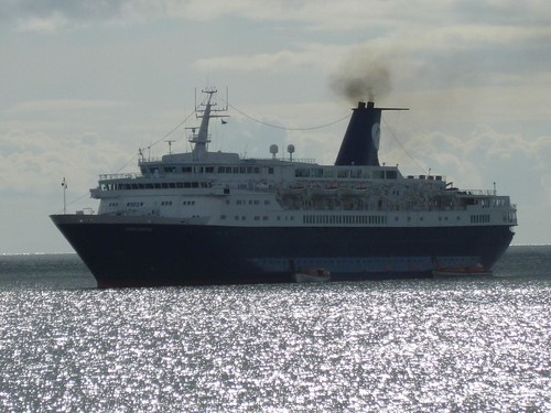
We once more have a cruiseliner in port, the Ocean Countess. Her passengers flock ashore, but wise to the extortionate coachtours they head for the service bus. However, local people and other tourists also want to go to Callanish, so it's handbags at lunchtime for a place on W2.
I'm monitoring the progression of Hurricane Irene up the East Coast of the US, and the main problem appears to be rain. The NHC is forecasting up to 20 inches, which is not an amount anyone wants to have within 24 hours. Another two tropical systems: typhoon Nanmadol is battering the north of the Philippines, and tropical storm Talas is creeping north - with Japan in its crosshairs.
We once more have a cruiseliner in port, the Ocean Countess. Her passengers flock ashore, but wise to the extortionate coachtours they head for the service bus. However, local people and other tourists also want to go to Callanish, so it's handbags at lunchtime for a place on W2.
I'm monitoring the progression of Hurricane Irene up the East Coast of the US, and the main problem appears to be rain. The NHC is forecasting up to 20 inches, which is not an amount anyone wants to have within 24 hours. Another two tropical systems: typhoon Nanmadol is battering the north of the Philippines, and tropical storm Talas is creeping north - with Japan in its crosshairs.
Saturday, 27 August 2011
Friday 26 August
A very nice day, with plenty of sunshine in the afternoon. It was quite warm in the sun, and lunch was had outside. The birds too took full advantage of the sunny weather, for you never know how long it is going to last round here. Fortunately, we have had quite a reasonable spell of weather here this month, and I'm not one to complain about temperatures in the upper teens (celsius) in the islands.
This week, we shall see three different cruiseliners in port. The Saga Ruby was in yesterday, today it is the Athena. Tomorrow, we'll have the Ocean Countess. It's all good business, and I hope the Visitor Centre at Callanish will have its water supply on - in recent times, they have had frequent outages on their water supply, and as the manager said on local news: "It's impossible to serve coffee and tea without water". Yep, I'd second that.
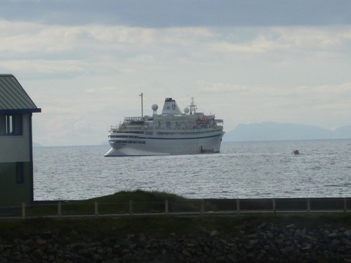
Athena
This week, we shall see three different cruiseliners in port. The Saga Ruby was in yesterday, today it is the Athena. Tomorrow, we'll have the Ocean Countess. It's all good business, and I hope the Visitor Centre at Callanish will have its water supply on - in recent times, they have had frequent outages on their water supply, and as the manager said on local news: "It's impossible to serve coffee and tea without water". Yep, I'd second that.
Athena
Thursday, 25 August 2011

Thursday 25 August
Libya: when will people stop selling the hide before the bear has been shot? Gaddafi is still at large, and until he is apprehended or killed, this mayhem will continue.
It's been a nice sunny day here in Stornoway, but it started rather cold: 6C at sunrise. We quickly made it up to 17C by lunchtime, which has been the norm this week. Over the weekend, we are on warning for a four-letter word. You know: a gale. Autumn is only just around the corner.
Got two more postcards from Postcrossing users, this time from Germany and Holland. Can thoroughly recommend it, doesn't need to cost you an arm and a leg.
It's been a nice sunny day here in Stornoway, but it started rather cold: 6C at sunrise. We quickly made it up to 17C by lunchtime, which has been the norm this week. Over the weekend, we are on warning for a four-letter word. You know: a gale. Autumn is only just around the corner.
Got two more postcards from Postcrossing users, this time from Germany and Holland. Can thoroughly recommend it, doesn't need to cost you an arm and a leg.
Hurricane update - 25 August
Hurricane Irene is presently moving through the northwestern Bahamas, en route for the Carolinas. Beyond that, the storm will parallel the east coast of the USA towards New York and New England. Although it is expected to be weakening at that point, Irene's impacts will be felt over a wide area. At the moment, winds of 40 mph or higher occur within 290 miles of the centre of the hurricane.
Wednesday 24 August
Spent today monitoring hurricane Irene, which is passing through the Bahamas with winds of 110 mph, and the situation in Libya. Gadaffi has been kicked out of his compound, but fighting continues in Tripoli and elsewhere. Next Thursday, 1 September, would have been the 42nd anniversary of his coup, back in 1969. Let's hope he takes it as a cue to formally relinquish power. Sigh, was that me dodging a flying pig?
I have also added more information on a tribute blog that I have set up for one casualty of the First World War, who perished in the sinking of the SS Kenmare off Holyhead in March 1918. His body was washed up north of Dublin, Ireland, a few days later. I am working with a man from the area to find out as much as possible about this incident, and the results will go on this blog. John Macaulay hailed from the village of Islivig, 40 miles west of Stornoway. This image, taken two years ago, shows the village road.
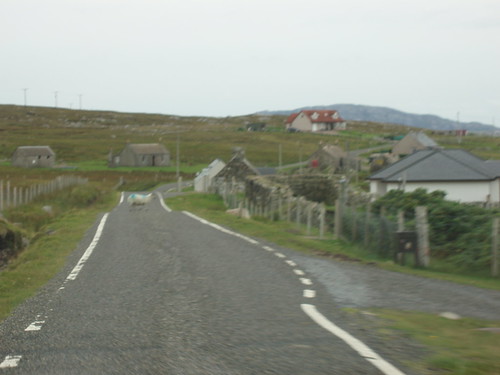
I have also added more information on a tribute blog that I have set up for one casualty of the First World War, who perished in the sinking of the SS Kenmare off Holyhead in March 1918. His body was washed up north of Dublin, Ireland, a few days later. I am working with a man from the area to find out as much as possible about this incident, and the results will go on this blog. John Macaulay hailed from the village of Islivig, 40 miles west of Stornoway. This image, taken two years ago, shows the village road.
Tuesday, 23 August 2011
Tuesday 23 August
An unremarkable day weatherwise, with some sunshine and no rain, temperatures reasonable (18C). Sat outside for half an hour to read more of the Count of Monte Christo. A delicious tale of revenge best served cold.
Events in Libya are moving fast, with the news this evening that Gadaffi's compound in the centre of Tripoli has been overrun, with the great Brother himself now in a spot of bother. He is thought to have bolted down a tunnel and possibly spirited away to his hometown of Sirte, east of his capital. His son made an appearance overnight, in spite of claims from the rebels that he had been captured. War is all about mis-information, don't forget.
The US East Coast was rattled by a magnitude 5.9 earthquake, which caused some alarm and damaged the Ecuadorean embassy in Washington DC. The jokes are already bouncing round the internet: "5.9? That's what the Californians stir their coffee with".
Hurricane Irene is moving away from Hispaniola as I type this, and will ratchet up to major hurricane strength overnight, with winds (well) in excess of 110 mph. Its further trajectory points at the US East Coast, which will get a comprehensive side-swipe from the storm over the weekend. This means heavy rain and high winds at the very least. Concerned? Monitor the National Hurricane Center.
Events in Libya are moving fast, with the news this evening that Gadaffi's compound in the centre of Tripoli has been overrun, with the great Brother himself now in a spot of bother. He is thought to have bolted down a tunnel and possibly spirited away to his hometown of Sirte, east of his capital. His son made an appearance overnight, in spite of claims from the rebels that he had been captured. War is all about mis-information, don't forget.
The US East Coast was rattled by a magnitude 5.9 earthquake, which caused some alarm and damaged the Ecuadorean embassy in Washington DC. The jokes are already bouncing round the internet: "5.9? That's what the Californians stir their coffee with".
Hurricane Irene is moving away from Hispaniola as I type this, and will ratchet up to major hurricane strength overnight, with winds (well) in excess of 110 mph. Its further trajectory points at the US East Coast, which will get a comprehensive side-swipe from the storm over the weekend. This means heavy rain and high winds at the very least. Concerned? Monitor the National Hurricane Center.
Hurricane update - 23 August

Hurricane Irene is starting to move away from the Dominican Republic towards the Bahamas. The storm is currently a category II hurricane, but will intensify to category III over the next 24 hours. The Turks & Caicos Islands as well as the Bahamas will feel the full fury of Irene, but at present, the islands have most to fear from the storm surge. This will come in at 9 to 13 feet (3 to 4 metres) above normal tidal levels. The Bahamas are relatively low lying, so the effects of the storm surge are potentially catastrophic. Maximum sustained windspeeds at present stand just below 100 mph, but will increase to 120 mph into tomorrow.
The current forecast states that Irene will plough through the Bahamas over the next few days, and will proceed to make landfall in the Carolinas by the weekend, as a major hurricane (meaning sustained windspeeds are 115 mph or higher). The exact location of landfall is at present impossible to predict.
Monday, 22 August 2011
Picture post - 22 August
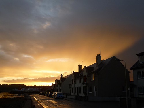
Sunset
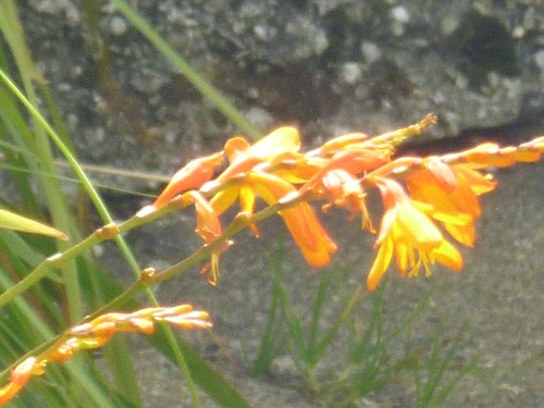
Mombretia in bloom
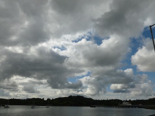
Cloudscape this afternoon
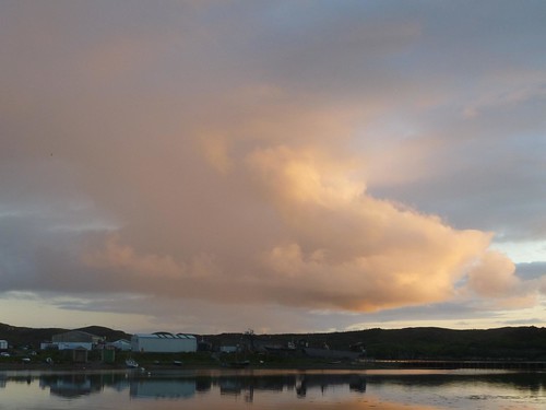
Cloudscape 18 August
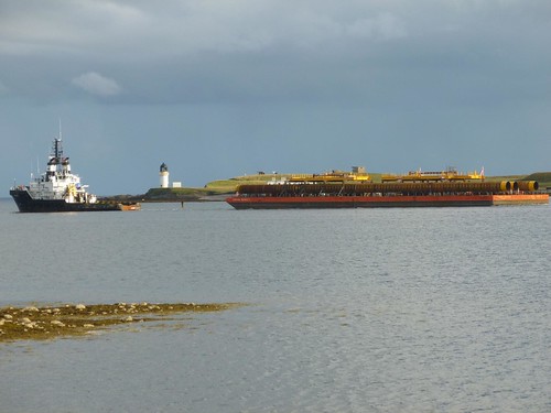
Tug & barge passing the lighthouse on 17 August
Monday 22 August
Quite a nice day, with good sunny spells, not marred by those rogue showers passing through. The sun went down, an hour ago, with some spectacular colours. As you can expect in weather conditions like those.
The news is dominated by events in Libya, which have suddenly jumped out to surprise us. The rebels have now taken over 80-95% of the capital, Tripoli; four of Gaddafi's sons are either captured or dead and the national TV station is off air. Heavy fighting continues around the compound where Gaddafi is thought to be holed up, and the situation remains fluid.
I have added another 30-odd pictures to the ShipSpotting website, to which I have been contributing since 2007. There are now 158 images of ships, boats and vessels of varying descriptions on my account. Quite a few of them are cruiseliners.
The news is dominated by events in Libya, which have suddenly jumped out to surprise us. The rebels have now taken over 80-95% of the capital, Tripoli; four of Gaddafi's sons are either captured or dead and the national TV station is off air. Heavy fighting continues around the compound where Gaddafi is thought to be holed up, and the situation remains fluid.
I have added another 30-odd pictures to the ShipSpotting website, to which I have been contributing since 2007. There are now 158 images of ships, boats and vessels of varying descriptions on my account. Quite a few of them are cruiseliners.
Hurricane update - 22 August
Hurricane Irene passed Puerto Rico in the early hours of the morning local time with winds of 75 mph at ground level. In the island's mountains, winds blew in excess of 110 mph. At present, the hurricane is moving away westnorthwest and has intensified to 80 mph, a trend likely to continue.The next island in its cross-hairs is Hispaniola, with the Dominican Republic at risk of not just high winds but also heavy rainfall. The NHC talks of 5 to 10 inches, with up to 20 inches in the mountains. The deforestation that occurred in Hispaniola in the 20th century will create a severe hazard of flashfloods and mudslides.
In the longer term, Irene will go through the Bahamas and veer north, paralleling the eastern coastline of Florida at 95 knots by Saturday. There is considerable uncertainty, but the indication is there.
Sunday, 21 August 2011
Sunday 21 August
I'm pleased to see so many people remembering the old J-land community, which lives on in a different shape on some people's blogs and Facebook accounts. There are some folk who do not believe in on-line communities, or "life on-line" in general. But there is genuine empathy in J-land as it exists today, so I'm happy to continue as is.
I have kept a quiet day today, watching an outrageous rendition of Gilbert and Sullivan's Pirates of Penzance on satellite TV and monitoring tropical storms Harvey and Irene in the Atlantic Ocean.
I'm pleased that Gaddafi appears to be on the way out, although I'm not prepared to sell that particular bear's hide until he's been taken out of the way. I do not condone killing people, even an evil b*****d like him. That would be the easy way out, and let him get away without giving account of his actions over the past six months.
I have kept a quiet day today, watching an outrageous rendition of Gilbert and Sullivan's Pirates of Penzance on satellite TV and monitoring tropical storms Harvey and Irene in the Atlantic Ocean.
I'm pleased that Gaddafi appears to be on the way out, although I'm not prepared to sell that particular bear's hide until he's been taken out of the way. I do not condone killing people, even an evil b*****d like him. That would be the easy way out, and let him get away without giving account of his actions over the past six months.
St Maarten / Saint Martin
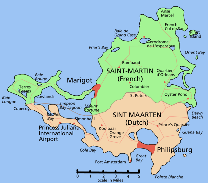
This small island lies in the far east of the Caribbean, and is currently being lashed by tropical storm Irene. What strikes me is that in the 2100 GMT advisory on the National Hurricane Center's website, the northern half of the island is subject to a tropical storm warning, but the southern half is not. The northern half is French, the southern half belongs to the Netherlands Antilles, government based in the island of Curacao.
Subscribe to:
Posts (Atom)