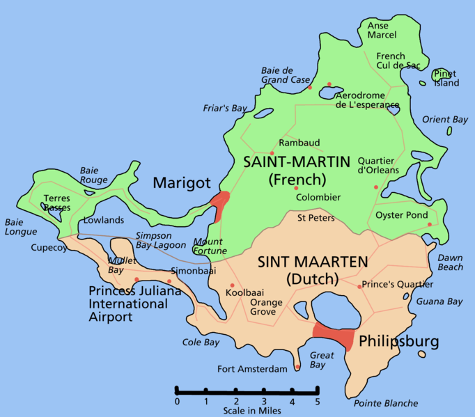
This is a map of the island of St Martin in the Caribbean. As the scale shows, it measures about 12 by 12 miles. It is part French and part Dutch - see this Wikipedia article for more details.The reason I'm flagging it up is that the two governments are not talking to each other with regards the approach of tropical storm Fiona. This tropical cyclone is not as strong as Earl, at the beginning of the week, but could still pack a nasty punch in the shape of rain. The bemusing fact is that according to the National Hurricane Center, the French part of the island is under a tropical storm warning, meaning that winds above galeforce could arrive within 24 hours; and the Dutch part is under a tropical storm watch - like the other islands in the vicinity, minus French St Barthelemy which, like St Martin, is also under warning. I have emailed the weather services for both halves of the island asking them to have a look at this situation.
Hurricane Earl meanwhile is on its way to the US East Coast, which it will graze. The Canadian Maritime provinces will see a lot more of Earl than they'd like - most likely a category I hurricane by that time.
In the Pacific, typhoon Kompasu is making a beeline for Korea, which can look forward to a typhoon strike with winds of 95 knots, that's 110 mph, near the South Korean capital, Seoul. North Korea is expected to experience the worst of Kompasu. After passing over the Korean peninsula, the storm will veer east and pass within reach of Vladivostok in Russia.
No comments:
Post a Comment