View across the Outer Harbour of Stornoway

Monday, 5 October 2009

Who is who?

Researching the two Rolls of Honour for the Isle of Lewis yielded a strange piece of confusion. Although I have requested assistance from the Historical Societies for Uig and East Loch Roag, I do not expect this to be cleared up anytime soon.

The two servicemen pictured below are both described as John Macleod from 1 Enaclete and Finlay Maclean from 36 Breasclete.

1916 Roll of Honour
Finlay Maclean, Breasclete, Roll of Honour 1916

1921 Roll of Honour

Finlay Maclean, 36 Breasclete - Roll of Honour 1921

1916 Roll of Honour
John Macleod, Enaclete - Roll of Honour 1916

1921 Roll of Honour
John Macleod, Enaclete - Roll of Honour 1921

Tropical storm Grace

In amongst the high powered drama being acted out in the northwestern Pacific, tropical storm Grace nearly slipped under the radar. This is a system which is located 575 miles southwest of Cork, Ireland and rapidly heading north to northeast. Because it is over waters of 18C, it is not expected to live long as a tropical cyclone, which requires water of 26C / 80F or warmer to be sustained. Nonetheless, I am extremely wary of tropical systems making it as far north as this; in 2007, a system called Gordon brought force 11 stormforce winds to the Irish Sea. In 1987, the remnant of Hurricane Charlie brought an unexpected hurricane to the southcoast of England as it sped up the English Channel.

I copy my entry from my Tropical Cyclones blog - I have noted the line "Threatened landmasses" as NONE; by the time Grace reaches any land, it will be part of a frontal system.

Tropical storm Grace / 09L
Warning 03 from NHC for 1500 GMT
Position 45.4N 16.4W
Location 575 miles SW of Cork, Ireland
Movement NNE at 28 knots
Maximum sustained windspeeds 55 knots
Maximum gusts 70 knots
Winds of 34 knots or higher occur within 70 miles to the south of the centre
Threatened landmasses NONE
Next update 2100 GMT

Monday 5 October

Fairly bright today after a very chilly start; the mercury went down to only just above freezing through the night. Up at 11C / 52F as I type.

It is 10 years ago today that a fatal train crash at Ladbrooke Grove, a few miles west of Paddington Station in London, claimed 31 lives and injured more than 400 others. An outbound local service had failed to note a red signal, and moved into the path of an incoming express, which was travelling at high speed. Although both drivers applied brakes, the trains collided with a combined speed of 80 mph. The collision was followed by a fierce fire, in which a large number of the dead perished. Both trains were diesel powered. At 8.11 am this morning, survivors and relatives of the deceased gathered at the memorial at Paddington.Two other rail disasters followed within 5 years: in October 2000, the Intercity from King's Cross to Leeds left the tracks outside Hatfield, Hertfordshire, due to a broken rail, claiming 4 lives. The eerie thing for me personally was that I had travelled on the same service, the 12.00 to Leeds, exactly a week before. Two years later, a train derailed at Potter's Bar, not far from Hatfield. The deathtoll here was 7.

Sunday, 4 October 2009

Boreraig and Suisnish

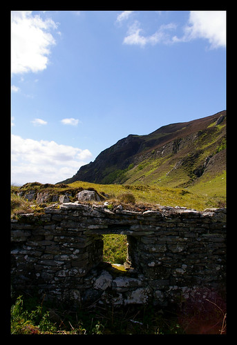
Boreraig and Suisnish were once communities in their own right, and my visit there was related to my interest in the history of Western Scotland. Both townships were cleared in the 19th century, and the villagers forced to abandoned home and hearth. Lock, stock and barrel, they had to load up and march east. The landowner did not give a damn what happened to the people. His land was now void of people, and he could do as he liked. The evictees meanwhile were trekking across rough country to Heast and on to Drumfearn. Their first night was spent on the bank of the Eishort River, in cold and wretched conditions.

My visit to Boreraig and Suisnish, in pretty awful weather conditions, was pitched in low mood on account of their history. The sad ruins stand as a memorial to those that were cast off in desultory fashion. Read David Craig's On the Crofters' Trail for the heart wrenching stories behind the Highland Clearances.

From the archives: Saturday 2 and Sunday 3 October 2004

Saturday 2 October 2004


Come downstairs to be met by the sight of a distracted warden who is taking all the hot water taps apart. Apparently, a new boiler was installed only recently, but it isn't working properly. Book into hostel for the weekend, then go on the bus to Broadford at 10.20. Fifteen minutes later, I'm dropped off outside the Post Office there.Walk over to the Post Office van marked Elgol, and jump on. I ask to bedropped off at Kilchrist, 4 miles southwest of Broadford. It's a bit of a tight squeeze on board, but that isn't going to be for a long time at any rate. Dropped off a few hundred yards beyond the church, near the reed covered Kilchrist Loch. Find the track that is supposed to lead to Suisnish on the coast, south of here. This is a derilict village, cleared of its inhabitants in the 19th century, together with its neighbour Boreraig. My efforts to reach Suisnish along this path are thwarted by some appalling weather. A shower kicks off, leaving me to dash for relative shelter amidst the ruins of Kilchrist village. There is a strong westerly wind, blowing the showers over the nearby Beinn na Cailleach. Once that has passed, I continue on my way, but I lose track of the path. Find myself scrabbling on the banks of the Allt na Inbhire, trying to cross. Well, I give that up as a bad job after half an hour, and make my way cross-country to the Marble Line walkway. This used to be a railway carrying marble from the quarry up the hillside to the pier at Broadford. It closed suddenly at 1912. This path is well maintained and signposted. After a gate, it worsens slightly to a rough hillpath. Crossing the fence at Loch Lonachan is troublesome because of standing water. This continues to be a nuisance, not helped by frequent heavy showers. The valley opens out, and I duly arrive into what I thought was Suisnish. How wrong can you be. After checking my bearings against various landmarks and their relative position, I have to concede that I am 2 miles out and actually in the enclosure of Boreraig. Wander through the sad remains of that village (pictured above, courtesy Flickr-user Deano-T) and try to eat something in the pouring rain. Carry on as far as the Boreraig River, then turn back.Get a massive scare outside the village, when I'm taking a break at 12.52. As I look northeast, I see a fierce blob of light. About 2 seconds later, a deafening crash follows. I'm in the middle of a thunderstorm and there is NO shelter. I wait for the storm to move away, crouching down, then go on my way north.


Once I rejoin the Marble Line path (pictured, courtesy Flickr-user Robinvanmourik, I feel like a train, going at 4 mph. Pass above some of the houses near Kilchrist, then the branch which leads to Coire Chatachan, below Beinn na Cailleach. The path finally ends under the high voltage power line,where I have to divert to the road. Do some shopping at the Broadford Co-op, then join the 6pm bus back to Kyleakin. The YH is still plagued by pipe trouble. Have a nice chat with other hostellers. One couple offer me a lift over to Broadford tomorrow, Sunday. This gives me the chance to do the walk to Boreraig and Suisnish properly. Weather prospects also appear to be better.


Sunday 3 October
After breakfast I was taken to Broadford, so that at 10 a.m., I was already heading down the Marble Line path again. Fairly bright day, and the path had had a chance to dry out. The crossing of the stile presented no big problems, and at midday I was back at Boreraig. Had a bit to eat, then resumed the trek at 12.20. The only thing was that by now, a big wall of grey had moved in from the west. After passing through Boreraig, the path became a narrow and precarious affair through rock and stone. Had to encourage sheep to move out of my way.It meanwhile started to rain with gusto, which made the path all the more hazardous. Due south of Carn Dearg, the path went up a crazily steep incline. With a little bit of handiwork, I arrived on the clifftop above Suisnish at 1.25. The view, for as much as there was, switched round to one of Strathaird and Loch Slapin. I found out yesterday that my boots were knackered. They are letting in water by the bucketfull, and I'm beginning to feel chilly. The passage through Suisnish (pictured, courtesy Flickr user blackpuddinonabike) is absolutely sodden. The path leads above the present-dayfarm buildings, then veers north. I slowly progress towards the road-end at Camas Malag. At 2.15, I encounter an elderly couple who want to go to Suisnish and ask me how far it is. Fifty minutes. I was a bit concerned because of their unsuitable footwear. Did not comment on that to their faces though. Arrived at Camas Malag at 2.30, and sat down on a hill just north of the road end. The rain had relented and was now showery. After half an hour, I carried on to the main road at Kilbride. This leads past a marble quarry, with the showers still going on. From that point, I had to walk along the B8083 Elgol - Broadford road. Not much of a bother because of light traffic. It just got alittle hairy along Loch Kilchrist, as I didn't have a lot of leeway, and the road runs along the loch shore. At Kilchrist, I cut through the wilderness to the Marble Line Path. I did not fancy a 3 mile roadwalk. It's a bit of a chore, and have to jump barbed wire, but I gain the path. Sit under a bridge to avoid a shower, then head north down the now-familiar curves of the Marble Line. At Broadford, I discover a dead sheep at the point where the path goes back to the road. From the village, I nip back to Kyleakin by Citylink bus.

Sunday 4 October

Quite a nice day, if a little on the cool side. The sun is out, although cloud was always present. The mercury struggled to get into double figures, but as there is very little wind, this is not very noticeable. Went out for a stroll around the Newton Basin, to check out this overturned boat which I noticed during yesterday's gale. Just as I came back, efforts began to right it. Which succeeded, 2 hours later. Whether it is still in working order after more than 24 hours of immersion into the briney waters of Stornoway Harbour is quite another matter.


Newton Basin, with the houses of Seaview Terrace in the background

The ferry did a run to Ullapool early this morning, to catch up with the backlog of traffic, caused by yesterday's cancellation of all crossings. It was unusual to see the Isle of Lewis coming into port at 1.30pm on a Sunday, but a welcome sight nonetheless. Yesterday's empty shelves caused by said cessation of services was later alleviated, when the lorries carrying our supplies diverted to Tarbert in Harris, where the ferry from Skye was still running.


MV Isle of Lewis entering port on Sunday afternoon

The rescue services across the Highlands and Islands have been busy this weekend, and not just keeping the yacht Elinca safe in Loch Tealasbhaigh in western Lewis. On Friday, a diver failed to return from a dive off Ardnamurchan Point, the most westerly point on the Scottish mainland, 100 miles south of Stornoway. Bad weather yesterday hampered the search, which was stood down yesterday afternoon. It was resumed today.

Saturday, 3 October 2009

Local yacht in trouble

Local yacht Elinca, shown left, is the focus of a rescue operation off the far west coast of Lewis. She ran into difficulty after a gearbox failure in stormforce winds this morning, and requested Coastguard assistance just before 9 am. The Coastguard helicopter R101 flew the 45 miles to Loch Tealasbhaigh, where Elinca was anchored in to a lee-shore. Five non-essential crew were airlifted to safety, and arrived at Stornoway airport about a quarter of an hour ago (heard the helicopter go by overhead). The lifeboat was sent to the scene, but as this involves a 60 mile trip north around the Butt of Lewis in force 9 to 10 conditions, she is only expected to arrive there about now, 4 hours after the call was first made.More information on the MCA website.

Location of yacht

Saturday 3 October


The west northwesterly wind is reaching galeforce, and the ferry is cancelled all day. Most of the ferry services in the west of Scotland are disrupted or cancelled. Showers are passing by at frequent intervals, and the rainfall radar looks like a severe case of blue measles.

Still we should not complain: typhoon Parma is battering the Philippines, and you should brace yourself for some more catastrophic news from that country. 

If you are flying in and out of the UK to or from the USA, you should expect major delays. The air traffic control computer at Prestwick, near Glasgow, has broken down and all incoming flights are handled manually. That is causing delays of several hours.

Friday, 2 October 2009

Looking down history

In recent years, I have assisted someone to trace their ancestors, using census returns. In Scotland, censes are taken every 10 years, starting in 1841. They are publicly available up until 1901; the 1911 census will become available in 2 years from now. A census provides an eerie look back down the year, showing a very narrow insight what was going on in the land on a specific evening. A babe in arms in 1891, for instance, living in a town in northeastern Scotland turns up visiting his aunts in Stornoway as a lad of 10 in 1901. The inaccuracies can provoke furious conjecture, particularly as the census takers in the Western Isles may not have been familiar with the Gaelic names and their spelling.

A different, more poignant insight, was created by an interim Roll of Honour here in the Isle of Lewis. There are actually two Rolls of Honour, one published in 1916 and the final one (for the First World War) in 1921. The 1916 Roll, which I finished transcribing this week, lists 4360 names, as opposed to 6030 in the 1921 list. Not all the names in the 1916 list are present on the 1921 list, and the total number of these discrepancies could run in the hundreds. The poignancy lies in seeing names of men, still alive in early 1916, who would die in later years of the war. The Battle of the Somme, which commenced on 1 July 1916, would claim many, as would the Iolaire Disaster on 1 January 1919. Quite a few other names are not on the 1916 list, as they had not yet joined up. I remember the case where one brother signed up for military service after his brother had been killed on the Western Front. Both never returned.

Image courtesy Daily Mail

Friday 2 October

Overcast and wet this morning. Tonight will see the advent of severe gales from the west, which will persist into tomorrow. Winds will gust up to 70 mph and I can see as plain as day that we are NOT going to have a ferry service tomorrow, neither a freight ferry. The Met Office has NOT issued a gale warning for our area. Yet.

Adverse weather conditions are certainly an understatement for conditions likely to affect the northeast of the Philippines. Typhoon Parma is headed for Aurora province in Luzon Island, with winds of 120 knots, that's 135 mph. Meanwhile, further east, Typhoon Melor is grinding west towards the Northern Marianas, with places like Guam and Saipan under threat of its 130 knots of wind, 145 mph. What comes next? Not really clear. Melor could head north towards Japan; the projected strength of wind in 5 days time, as it approaches Kyushu is still 140 knots. The forecast for Parma has more holes in it than a Swiss cheese, so I would not like to be the forecaster in charge of that system.

Laxford Bridge in northwest Sutherland, which was closed yesterday after an army transporter fell off it, is to be reopened to light traffic later today. Lorries are still being diverted east and north. Good news for local residents though, who were concerned about emergency cover.

Thursday, 1 October 2009

Road closed


An accident involving an army lorry has closed the A838 road in northwestern Scotland, causing lengthy detours for people heading for the villages of Rhiconich, Kinlochbervie and Durness. The lorry toppled off the bridge at Laxford Bridge, causing damage to the bridge. The three gunners on board escaped with minor injuries. The road is likely to remain closed for some time, forcing travellers to divert east and north, through Altnaharra and Tongue. For instance, the 30 mile journey from Lairg to Laxford Bridge will now be 80 miles long. (Image courtesy BBC.)

From the archives: Friday 1 October 2004

At Inverness
Went to the station to catch a train to Kyle of Lochalsh. It's still a nice trip, and the weather has improved on yesterday's rain - at least it's dry. Trundle my way west in 2½ hours, arriving in Kyle at lunchtime. I go into the station building to have a look in the museum. Have to be careful with my pack, which I leave at the door. Part of the museum is without electricity as a result of flooding. Nice display of railway memorabilia. Walk into the village, after glancing out to the warship that lies moored at the pier. Nipped into the Tourist Information Office for some ideas, and there is a tour with a glass-bottemed boat. Before setting out, I walk through the village to a viewpoint above Kyle which looks out to Skye, the bridge and east up Loch Alsh. At 1.30, there is too little clientele in the tour, but at 2.30 there is sufficient interest to warrant the man to set forth. It's very interesting to look out under the water and see all the junk on the floor, the different types of fish and seaweed. We head out to a clump of skerries in the Kyle to view a colony of seals that are basking there. Not in the sun, it's cloudy. Then we sail to the far shore to observe the wreckage of a minelaying vessel which blew up in 1941. A fire had broken out on board, and it was towed across the Kyle. Had it blown up at the quayside, the village would have been devastated. View beds of seaweed on the way back to Kyle. After the trip in the glass-bottomed boat, I walk over the Skye Bridge to Kyleakin. Just before the span of the bridge proper, you pass the cottage on Eilean Ban, where Gavin Maxwell lived, of otter fame. He died there in 1969. There is a gate to the bridge, and I believe you can stay there. At the bottom of the bridge, I turn left on the roundabout and wander into the village. Kyleakin has improved for the better since the bridge came, 9 years ago. The big marshalling yard for the ferry is now a neat carpark. I arrive at the youth hostel at 4pm, an hour early. Leave the rucksack there and try to walk into a sideroad just off the bridge roundabout. The farm at the end has everything fenced off, so no access. Try the main road to Broadford, but that only has limited stretches of secluded old road. Have to double back to Kyleakin. Check into the hostel at 5pm and am allocated a bed in room 6, which has only 2 beds in it, plus a sink. Go downstairs to prepare my dinner and have a nice chat with other hostellers. Who describes my surprise when I meet up with some folk who were with me at Kirkwall earlier in the week. Use the laundramat. Saw a musical event advertised for tonight in the Saucy Mary pub, across the green. Go there at 10, but the music is no good, neither is the beer. Have a very poor night's sleep, on account of some heinous rattle and clanging in the pipes of the central heating system.

The ferries at Kyle of Lochalsh in 1992, before the bridge was built


Kyleakin Harbour


Kyleakin; Youth Hostel to the left, Skye Bridge to the right

Thursday 1 October


Today is the first anniversary of Atlantic Lines, and it's also just about five years ago since I started on this blogging lark. Although distractions like Facebook and Twitter have come along, I still find the best way for me to write fully is on here. Our community, which we knew as J-land, has disappeared, for all intents and purposes. Although many are still in touch through Blogger and other platforms, the community spirit is no longer there.

Today is also the start of October, with summer finally behind us. As I said a little while ago, the Western Isles of Scotland lost their summer in the middle of July - it has been at best mediocre since. Today is overcast and cold, with the mercury only just getting into double figures: 10C at the moment. Tomorrow will see a deterioration in the weather, with a gale springing up later in the day. I have adjusted the graphics in the sidebar accordingly.

The Pacific is bracing itself for a double whammy of supertyphoons. Parma is currently at 130 knots (a trifling 150 mph), and Melor will follow suit, reaching an incredible 145 knots, which equates to 170 mph winds - sustained. The gusts will be as high as 200 mph. The Northern Marianas Islands are in line for Melor, while Parma will deal Luzon Island in the Philippines a glancing blow.

Wednesday, 30 September 2009

One year on

On 30 September 2008, AOL gave us a month's notice to quit and abandon our journals. Yes, it's a year ago. Tomorrow will be the first anniversary of this blog, Atlantic Lines. As I said a few days ago, much has changed. Not always for the better, but not necessarily wholly for the worse either.

On 30 September 2004, I was in the process of relocating from the Northern Isles to the Western Isles. I'll post that day's diary entry below.

For the first time in weeks, I had a room (or more accurately: a cabin) to myself. At 7 a.m., I found myself in a rain- and windswept Aberdeen. Delayed my departure from the ferry until the latest possible hour. Slouched off into the city at 10 a.m.. First thing needed: a townplan. Second: a post office, to send off maps and other stuff related to Orkney that was no longer required. A dark-coloured lady tried to chat me up in the PO, what a laff. Spent the rest of the morning sloping round the soaking-wet streets, with that bloody big pack on my back.Want to find the library, but Aberdeen, the Granite City, is very grey and even greyer in this rain. After I buy a pastry in a shop, and miserably eat it on a bench, I locate the library. I walked past it several times during 40 minutes, just past the Robert Gordon University. No, the library wasn't that great either. Few terminals, very limited time, and the terminal I was on crashed. Went to the station and found there was a train to Inverness at around 3pm. I was on it. Aberdeen I just do not like. Folk are friendly enough. Train departed at 3.25 and it was pretty full. As we went east, the rain relented although it stayed overcast right the way through. I can't say I'm riveted by the Moray or Aberdeenshire countryside - sorry, was in a foul mood all day today. Arrived in Inverness at 5pm, and booked into the Youth Hostel on Millburn Drive. Then went back to the Safeway for shopping. Had a lot of bother finding my way round, I had become quite used to the Co-op and Safeway stores in Kirkwall. Cooked supper,did the laundry, went on the Internet using vouchers. Fairly good deal: £1 for 20 minutes, or 24 minutes if you join the club. As membership was free, I gladly joined back in Kirkwall. Show a couple of young hostellers how to use the laundry machines. There is a group of disabled kids in who are on a trip out of Shetland. In Inverness, you can only get into the rooms using a swipe card. Some strange characters in my room tonight. Typical Mediterraneans, don't like them.

From the archives: Wednesday 29 September 2004

In the morning, I jump on the bus to the Houton Ferry, to go to Hoy. Crossing was rendered uninteresting, because we were required to stay below decks all the way to Lyness. On arrival, I have to time my walk carefully. Lyness itself is just plain unsightly. It used to be part of the Scapa Flow naval base, and after the war the Royal Navy just pulled out and sailed off into the sunset. The base was just left to fall to ruin. Worst are all the buildings, also scattered over the hillside beside the village. I walk north along the B9048, in the general direction of Moaness, at the northern end of Hoy. After about 45 minutes, I have left the village and am in the farming area of the island. Workmen are laying long stretches of blue piping, which I later learn are water mains. At 12.45, I reach a picnic site by Pegal Bay.This abuts a small, fenced-off nature reserve. All along this road you'll encounter milestones, totting up the distance between Lyness and Moaness. After Pegal Bay, the road veers inland to cross over the shoulder of Pegal Hill to Lyrawa Bay. Below Lyrawa Hill, 5½ miles / 9km outside Lyness, I encounter Betty Corrigal's grave. This is a recent feature, a fibre-glass tombstone dedicated to the memory of a young woman who committed suicide after falling pregnant out of wedlock in the 18th century. She fell for the charms of a sailor, who afterwards disappeared. She was buried in an unmarked grave, because suicides are not buried in consecrated ground. She lay undisturbed for 160 years, until her coffin was found by peat cutters in 1930. Her body had remained virtually intact, only the noose beside her had turned to dust. She was reburied, but during WW2, sailors frequently got her out. Finally, in 1949, she was buried for the last time. An American minister asked for the current headstone to be erected, but this was not done for another 27 years. After a moment or two, I squelched my way back to the road. I walked up the track, onto the nearby Lyrawa Hill, to view the gun emplacements that lie abandoned there. Nice views east, towards Wideford Hill near Kirkwall, and the hills above Houton. At 2pm, I went back towards Lyness. Forty minutes later, I was very kindly offered a lift back to Lyness by an elderly Australian couple who were here to trace ancestors by looking round graveyards. Their car made short shrift of the remaining 4 miles, and I was left with 1½ hours to kill around Lyness. Wandered up the hill to an ugly, derilict, concrete building that looked as if it had been some sort of HQ. Everything covered in layers of dirt, electrical wiring hanging all over. To escape the chilly north wind, I sat down in the lee of the building for a cuppa. Then ambled down to the ferry terminal. Ferry arrived at 4pm, but they raised the ramp again. It's not due to sail until 4.40. Have a look round the Scapa Flow museum, and the hazardous dockside. Ferry leaves on time, and I'm having a pleasant chat with a nice couple in their mid 50's. They offer me a lift back to Kirkwall once at Houton. One other person joins me in the car, but not before somebody returns me a glove I had dropped somewhere. I'm dropped off outside Safeways for shopping at 7pm. On return to the hostel, I decide to take the late ferry to Aberdeen. A quick taxiride at 10.30 duly delivers me to Hatston, where the ferry lies docked. After about 10 minutes, I'm allowed on board. Am shown to my cabin, where I take a shower, then retire for the night. The ferry sails at midnight, and exactly 4 weeks after arriving in Orkney, I'm leaving the islands. The swell rocks me to sleep.

Postscript: I'd be back in Orkney in October 2008 - will post pictures in a later entry

Train crash


Image courtesy Press and Journal

Yesterday afternoon, just after 2pm, the 1038 Inverness to Thurso train collided with a car on a level crossing at the village of Halkirk in the far north of Scotland. Its 3 occupants were killed, one of them was flung from the vehicle. The train came to a halt about a quarter of a mile down the track. It had been travelling at 50 mph when the collision happened. Investigations into the cause of the accident are on-going, and the names of the deceased have not yet been released, such pending the outcome of a post-mortem. None of the 18 passengers and 4 crew was hurt on the train. They were transferred to a nearby hotel. The train was taken to nearby Georgemas Junction railway station.

Services to Thurso and Wick remain suspended; trains from Inverness terminate at Forsinard Station, from where buses are put on. Travellers are advised to allow an extra 60 minutes for their journeys. More details here.

My sympathies are with the relatives and friends of the victims, who are reported to be elderly.

The Sun


Logo courtesy http://goalpost.wordpress.com

The Sun is a tabloid newspaper here in the UK with the highest readership, put at over 3 million copies sold each day. It is (in)famous for page three girls (who show off their assets). I usually glance at the paper when I'm buying my daily rag, the Press and Journal. I have very little time for The Sun, as it contains very little news (IMHO). I'll leave it at that.

Political Britain was all afluster today when The Sun announced it was no longer backing the Labour party (who have been in government since 1997), and instead switched its allegiance to the Conservatives. Only in Scotland did the Sun shift from Labour to nobody else. That's a piece of non-news if ever I heard one. The Sun, as I stated above, does not carry news (of note), and its editorial stance looks as if it is written on a sheet of lavatory paper. Yet it has delusions of grandeur, saying it backs winners in general elections.

This shift in political allegiance is very nice for the Conservative Party, as much as it was not nice for them in 1997, when the Sun started backing Tony Blair's Labour Party. It does show that The Sun has not got an opinion of its own, it does not stand for anything. The paper's editor has said that it backs the party that best appears to serve the interests of its readers.


Some people think that the Sun is for those who cannot be bothered to engage their brain. That's not true. You have to think very hard to read the Sun. Because you DO have to think for yourself - is what the Sun thinks is good for you really good for you?

Wednesday 30 September

September goes out with a bang, several bangs in fact. Typhoons, earthquakes, tsunamis and flooding. It almost sounds like the four horsemen of the apocalypse. Typhoon Ketsana started off by causing severe flooding in Manila on Saturday, dumping more than 16 inches of rain on the Philippino capital in 12 hours. More than 100 people lost their lives, and they are still cleaning up. Three days later, Ketsana had blown up into a fully fledged, category II typhoon and slammed into Vietnam. A similar deathtoll, and a similar number of people homeless - 730,000 in the Philippines and Vietnam combined. Even northern Cambodia was affected, and 11 lives were lost there.

Ketsana had barely disappeared from the weather charts when the Earth had an itch and jolted 3 inches under the Pacific. Six and a half miles of water were bumped upward and outward, and swamped the Samoan islands with a 25 feet tsunami. Even Hawaii, thousands of miles away to the northeast, saw 5 feet of tsunami running by. The devastation in Western and American Samoa is huge, and the deathtoll as yet incomplete. Yesterday evening, as the wave rolled round the Pacific, I (and hundreds with me) spent several hours relaying warning messages on Twitter.

Twelve hours after the Samoan quake, which measured 8.3 on the Richter scale, the earth moved again, and this time it was Sumatra that bore the brunt. Although no sizeable tsunami was generated, the devastation in western Sumatra was once more huge. The death toll at time of posting was quoted as at least 1,000, and probably much higher.

More natural disasters loom for the Pacific in the next few days. Two typhoons, one actual and one in the making, are shunting up Typhoon Alley to the east of the Philippines. Melor will slam into Guam on Saturday with winds near 110 mph, whilst Parma (further west) could cause problems in Luzon Island, Philippines before making for Taiwan.

The Atlantic hurricane season? What's that?? There have so far been 6 named storms, of which 2 in September, which is supposed to be the peak of the hurricane season. I am pleased for those in Hurricane Alley who (so far) have been spared the worst, although you should never count your chickens before they're hatched - and there is two months of the season left. The reason for the quietude of the Atlantic this year is an abnormal temperature pattern in the eastern Pacific, which is warmer than usual - it is called El Nino. As a result, atmospheric conditions are unfavourable for tropical cyclones to form in the Atlantic. Long range forecasts state that a tropical cyclone could form in a week or so from now. I'm keeping an eye on developments on my TC blog.

Western Isles residents wanted for study

A PhD student from Lancaster is looking for residents of the Western Isles who are willing to give an hour or so of their time to talk about the use of language. Α project is being run across the UK and Ireland about the difference between how older and younger people speak and how they feel about it.

If you are interested to participate, or know people who want to take part, please leave a brief note in comments. I’ll relay the email address (which will show up in the comment notification) to the academic concerned, and you can then make arrangements direct. Confidentiality will be upheld by this blogger, and for anyone participating in the study.

Please relay.
Thank you.

Tuesday, 29 September 2009

Tsunami

The PTWC is currently under heavy demand, and it is best to put their link into your feedreader, and keep abreast of developments that way. Waves of 5 feet in height have washed ashore in nearby islands at intervals of 8 minutes (which can be up to 1 hours apart). Over the next 5 to 6 hours, waves are expected to propagate across the Pacific. Warnings and watches remain in force until further notice.

LOCATION         FORECAST POINT     COORDINATES     ARRIVAL TIME
 --------------------------------    ------------    ------------
 AMERICAN SAMOA   PAGO PAGO          14.3S 170.7W    1759Z 29 SEP
 SAMOA            APIA               13.8S 171.8W    1810Z 29 SEP
 NIUE             NIUE IS.           19.0S 170.0W    1822Z 29 SEP
 WALLIS-FUTUNA    WALLIS IS.         13.2S 176.2W    1835Z 29 SEP
 TOKELAU          NUKUNONU IS.        9.2S 171.8W    1844Z 29 SEP
 COOK ISLANDS     PUKAPUKA IS.       10.8S 165.9W    1846Z 29 SEP
                  RAROTONGA          21.2S 159.8W    1929Z 29 SEP
                  PENRYN IS.          8.9S 157.8W    1954Z 29 SEP
 TONGA            NUKUALOFA          21.0S 175.2W    1851Z 29 SEP
 TUVALU           FUNAFUTI IS.        7.9S 178.5E    1932Z 29 SEP
 KIRIBATI         KANTON IS.          2.8S 171.7W    1935Z 29 SEP
                  FLINT IS.          11.4S 151.8W    2025Z 29 SEP
                  MALDEN IS.          3.9S 154.9W    2037Z 29 SEP
                  CHRISTMAS IS.       2.0N 157.5W    2100Z 29 SEP
                  TARAWA IS.          1.5N 173.0E    2104Z 29 SEP
 KERMADEC IS      RAOUL IS.          29.2S 177.9W    1938Z 29 SEP
 FIJI             SUVA               18.1S 178.4E    2003Z 29 SEP
 HOWLAND-BAKER    HOWLAND IS.         0.6N 176.6W    2008Z 29 SEP
 JARVIS IS.       JARVIS IS.          0.4S 160.1W    2028Z 29 SEP
 NEW ZEALAND      EAST CAPE          37.7S 178.5E    2044Z 29 SEP
                  GISBORNE           38.7S 178.0E    2100Z 29 SEP
                  NORTH CAPE         34.4S 173.3E    2112Z 29 SEP
                  NAPIER             39.5S 176.9E    2140Z 29 SEP
                  WELLINGTON         41.3S 174.8E    2150Z 29 SEP
                  AUCKLAND(E)        36.7S 175.0E    2212Z 29 SEP
                  AUCKLAND(W)        37.1S 174.2E    2239Z 29 SEP
                  LYTTELTON          43.6S 172.7E    2255Z 29 SEP
                  NEW PLYMOUTH       39.1S 174.1E    2317Z 29 SEP
                  NELSON             41.3S 173.3E    2323Z 29 SEP
                  DUNEDIN            45.9S 170.5E    2331Z 29 SEP
                  MILFORD SOUND      44.6S 167.9E    2358Z 29 SEP
                  WESTPORT           41.8S 171.6E    2359Z 29 SEP
                  BLUFF              46.6S 168.3E    0044Z 30 SEP
 FR. POLYNESIA    PAPEETE            17.5S 149.6W    2045Z 29 SEP
                  HIVA OA            10.0S 139.0W    2214Z 29 SEP
                  RIKITEA            23.1S 135.0W    2247Z 29 SEP
 PALMYRA IS.      PALMYRA IS.         6.3N 162.4W    2102Z 29 SEP
 VANUATU          ANATOM IS.         20.2S 169.9E    2117Z 29 SEP
                  ESPERITU SANTO     15.1S 167.3E    2123Z 29 SEP
 NAURU            NAURU               0.5S 166.9E    2138Z 29 SEP
 MARSHALL IS.     MAJURO              7.1N 171.4E    2147Z 29 SEP
                  KWAJALEIN           8.7N 167.7E    2220Z 29 SEP
                  ENIWETOK           11.4N 162.3E    2309Z 29 SEP
 SOLOMON IS.      KIRAKIRA           10.4S 161.9E    2155Z 29 SEP
                  GHATERE             7.8S 159.2E    2227Z 29 SEP
                  AUKI                8.8S 160.6E    2244Z 29 SEP
                  HONIARA             9.3S 160.0E    2244Z 29 SEP
                  PANGGOE             6.9S 157.2E    2245Z 29 SEP
                  MUNDA               8.4S 157.2E    2248Z 29 SEP
                  FALAMAE             7.4S 155.6E    2304Z 29 SEP
 JOHNSTON IS.     JOHNSTON IS.       16.7N 169.5W    2212Z 29 SEP
 NEW CALEDONIA    NOUMEA             22.3S 166.5E    2216Z 29 SEP
 KOSRAE           KOSRAE IS.          5.5N 163.0E    2233Z 29 SEP
 PAPUA NEW GUINE  KIETA               6.1S 155.6E    2303Z 29 SEP
                  AMUN                6.0S 154.7E    2323Z 29 SEP
                  RABAUL              4.2S 152.3E    2349Z 29 SEP
                  LAE                 6.8S 147.0E    0015Z 30 SEP
                  KAVIENG             2.5S 150.7E    0016Z 30 SEP
                  PORT MORESBY        9.3S 146.9E    0039Z 30 SEP
                  MADANG              5.2S 145.8E    0041Z 30 SEP
                  MANUS IS.           2.0S 147.5E    0050Z 30 SEP
 HAWAII           NAWILIWILI         22.0N 159.4W    2311Z 29 SEP
                  HILO               19.7N 155.1W    2314Z 29 SEP
                  HONOLULU           21.3N 157.9W    2315Z 29 SEP
 POHNPEI          POHNPEI IS.         7.0N 158.2E    2318Z 29 SEP
 WAKE IS.         WAKE IS.           19.3N 166.6E    2322Z 29 SEP
 PITCAIRN         PITCAIRN IS.       25.1S 130.1W    2329Z 29 SEP
 MIDWAY IS.       MIDWAY IS.         28.2N 177.4W    2349Z 29 SEP
 CHUUK            CHUUK IS.           7.4N 151.8E    0020Z 30 SEP
 AUSTRALIA        BRISBANE           27.2S 153.3E    0036Z 30 SEP
                  SYDNEY             33.9S 151.4E    0038Z 30 SEP

Pacific Tsunami

Copied from PTWC:

A TSUNAMI WARNING AND WATCH ARE IN EFFECT ...

A TSUNAMI WARNING IS IN EFFECT FOR

AMERICAN SAMOA / SAMOA / NIUE / WALLIS-FUTUNA / TOKELAU /
COOK ISLANDS / TONGA / TUVALU / KIRIBATI / KERMADEC IS / FIJI /
HOWLAND-BAKER / JARVIS IS. / NEW ZEALAND / FR. POLYNESIA /
PALMYRA IS. / VANUATU / NAURU / MARSHALL IS. / SOLOMON IS.

A TSUNAMI WATCH IS IN EFFECT FOR

JOHNSTON IS. / NEW CALEDONIA / KOSRAE / PAPUA NEW GUINEA /
HAWAII / POHNPEI / WAKE IS. / PITCAIRN / MIDWAY IS. / CHUUK /
AUSTRALIA

FOR ALL OTHER AREAS COVERED BY THIS BULLETIN... IT IS FOR
INFORMATION ONLY AT THIS TIME.

THIS BULLETIN IS ISSUED AS ADVICE TO GOVERNMENT AGENCIES. ONLY
NATIONAL AND LOCAL GOVERNMENT AGENCIES HAVE THE AUTHORITY TO MAKE
DECISIONS REGARDING THE OFFICIAL STATE OF ALERT IN THEIR AREA AND
ANY ACTIONS TO BE TAKEN IN RESPONSE.

AN EARTHQUAKE HAS OCCURRED WITH THESE PRELIMINARY PARAMETERS
NOTE THE MAGNITUDE UPGRADE TO 8.3

ORIGIN TIME - 1748Z 29 SEP 2009
COORDINATES - 15.3 SOUTH 171.0 WEST
DEPTH - 33 KM
LOCATION - SAMOA ISLANDS REGION
MAGNITUDE - 8.3

From the archives: Tuesday 28 September 2004


Houton Ferry Terminal, Orkney Mainland


The weather has quietened down since Sunday's gale, and there is now only a gentle greeze. I go into town to hire a pushbike. At 11, I paddle down the Old Scapa Road after a preliminary circuit of the town centre. This took me down Junction Road to the Orkney Ferries terminal, then along all sorts of back roads to the cathedral. At 11.10, I'm heading southwest along the A964 towards Orphir. It's a nice, sunny day and make good progress. Consider a shortcut at Kirbister to Finstown, but don't like the prospect of hills. Have an interchange with a tourist bus, all along the road to Scapa Garage. On arrival at Houton Terminal, it's 12.30. It's a steep descent from the main road. Nice view across to Hoy. There are two piers here, one of which is the terminal for the ferry to Lyness, Hoy. Watch the world go by behind the ferry office, then head off when the ferry comes in. By that time, I've finished lunch. Back up the hill to the main road, then left towards Brig o'Waithe. The view opens out to Graemsay and Stromness, but it's a long, long way to the A965, particularly with a headwind. Backside gets sorer and sorer as I go along, but ** finally ** I gain the main road.Turn right and am now running the gauntlet of all the traffic. Pass the sideroad to the monuments, then stop off at a petrol station to buy an icecream and a coke. As I progress further east, the weather decides it's warm enough for a shower. So, at the corner of the A986, I hide in the busshelter to don my waterproofs. Reach Finstown without further mishap. Here I decide to go to Kirkwall along the Old Finstown Road, if only to avoid the traffic. Well, I'm not very good at hills and there is a lot of traffic on this road as well. Decide on a break a little way west of Smerquoy Farm, but sitting in the verge of the road isn't that nice either. Get overtaken by a full schoolbus, and finally sail into Kirkwall at 5pm. Blimey, wasn't I knackered. Return the bike to the shop on Tankerness Lane, drop into the Internet Café across the road. This is part of an IT training enterprise, which also serves coffee and snacks. Return to the hostel after shopping at Safeways.

Ketsana

As I reported in my previous post, this typhoon has now made landfall in Vietnam. Initial local reports state that at least 23 people have been killed by the storm, with 170,000 evacuated. Windspeeds reached 90 mph.

Image courtesy NPR / AP

The storm surge, which accompanies tropical cyclones, has swept 1 km inland at Hoi An, threatening hotels and other buildings at the resort. 

Tuesday 29 September

Well, we have the sun back. In abundance. Brilliant day, after several days of rain and murk. I don't really mind the rain and / or wind, but several days in the row gets a bit depressing.

There is an alert concerning the cervical cancer vaccination Cervarix. A girl of 14 died on Monday after the jab was administered, and tests are currently on-going in the exact cause of death. Meanwhile, parents are being urged to be vigilant towards any adverse reactions, displayed by their daughters following administration of Cervarix. The programme of vaccinations is currently suspended, but will resume shortly. If this concerns any of your family (in the UK, or elsewhere), please read this BBC news article carefully.

The Pacific currently has 4 tropical cyclones on the go. Typhoon Ketsana, which wrought havoc in the Philippines over the weekend, is making landfall in Vietnam, 110 miles southeast of Hue, with winds of 110 mph. The city of Da Nang, some 80 miles from Hue, reported sustained winds of 48 mph over the past 24 hours. Tropical storm 18W is going through the northern Marianas with galeforce winds. Parma is on its way, about 400 miles in its wake, with 20W some 850 miles east of Guam.

Monday, 28 September 2009

Monday 28 September

Overcast and wet, as a frontal zone moves west to east over the islands - aligned west to east. We're in the middle of a 48-hour spell of rain. Quite uncommon actually. We get rain frequently, showers, rainbands, but they don't usually stop for such a long period of time. A local twitterer remarked that this was the time to view Stornoway Grey, a dig at a certain car manufacturer who is marketing one their models in that hue.

As I mentioned in the preceding post, the Philippines were deluged on Saturday by tropical storm Ondoy / Ketsana. Over the weekend, I was unable to access the islands' typhoon warning website. Far worse than that, dozens of people drowned and the emergency services are barely able to cope with the aftermath. The Philippines are affected by tropical cyclones every year, and rainfall tends to be causing more problems than actual winds. Ketsana carried winds that were barely above galeforce. But it did dump a month's rainfall in 12 hours on the Philippines capital, Manila.

Hurricane update - 28 September

More accurately: typhoon update. The news reports this weekend have been full of the names Ondoy and Ketsana, both referring to the same tropical cyclone. After drowning the Philippines on Saturday, Ketsana drifted into the South China Sea and blew up into a typhoon (which is the same as a hurricane). At the moment, the forecasters put this system as a category II typhoon, with winds of 90 to 110 mph. Ketsana is headed due west, along the parallel of 15.8 degrees North, and is currently lashing the Paracel Islands. Landfall will occur tomorrow morning local time, between the towns of Dà Nang and Quang Ngãi. Apart from the high winds and torrential rains, Ketsana can also be expected to bring a storm surge ashore of 15 to 20 feet.

The forecasters are tying themselves in knots over two nascent tropical cyclones, prosaically named 18W and 19W, which lie some 450 miles apart to the south and southeast of the Marianas Islands in the Pacific. Because they are so "close", it is a gamble as to which one will gain the upper hand. Either way, there'll be another typhoon to the east of the Philippines before the week is out.

Sunday, 27 September 2009

From the archives: Monday 27 September 2004

For the morning session, I walk out at 10 o'clock, heading east out of the town centre towards Inganess Bay. This takes me along the road to the B&B where I stayed nearly 3 weeks ago. Once past there, the road veers off right; the road to Berstane Farm carries on straight ahead. When I reach a wood, filled with junk, I am confronted with a sign saying "Private", and I have to backtrack a little way. Then I jump over a gate and head south along the perifery of the wood. Can continue along the fence for nearly a mile, with views opening up over the airport. To my left lies the Creag of Berstane. Also see a windturbine near Heatheryquoy Farm. Cannot go there in a direct line, but have to veer right along fencing to Inganess Farm. Once on the minor road, I head east, downhill, to the salmon farm. I can drop down to the sands of Wideford, but have to rejoin the top of the seawall after the salmon farm. From here, a new-looking signposted walk leads me back to Scapa. The route is punctuated by some horrendously steep stiles, but finally I arrive at the A960 road to the airport. Cross this with care and carry on along the path. With some difficulties in orienteering, I reach the A961 Burwick road at midday. Cross with care and head into the road that leads to and past Fea Farm. From here, the track winds itself down a messy looking slope to Scapa Pier. This is familiar territory and I easily walk back to the YH on Old Scapa Road. After lunch, I join the bus which will take me to the Bishop's Palace and nearby Brough of Birsay (on the far northwestern corner of Orkney Mainland). The bus goes past Finstown, then down the A986 along such places as Doune and Twatt. People alight at various places along the way, some of them quite jolly. Many have been into town to do their shopping, and are now lumbering it home. Reach Birsay at 2.30. A few people get off here, several joining the bus for the journey back to Kirkwall. First of all, I have a look inside the small church dedicated to St Magnus. A little bare - have a look at this link http://www.birsay.org.uk/stmagnus.htm.
Also have a look inside the ruined Earl's Palace, of which only a few feet now remain of its walls. In every room, a little note tells the story about it. Having walked through the ruins, I finally make my way to the Brough. This lies about a mile west of Birsay village and is a tidal island, only accessible at low tide. A concrete slabbed walkway provides a fairly safe if slippery access route. On arrival at the other side, I say hello to the warden and start by looking round theViking settlement, of which only foot-high walls remain. It included achurch. Then I go on a walk around the island, which has some pretty high seacliffs, up to 40 metres / 135 ft high. Like the views down the coast to Marwick Head, with cliffs up to 80 metres / 265 ft high. Pass the lighthouse, where a cleft, only a few inches wide, crashes down to sealevel. The coastline is eroding badly, and you have to be very cautious. I walk along, latterly with two other people in the distance. Cross the causeway back to the mainland at 4pm, and stay behind to watch the tide coming in. Have a little walk along the coastline to Skipi Geo, where people used to store their boats high up on the shore, in a shed. Sit down with two other walkers to enjoy the afternoon sun for a while. Then head back to the carpark to watch the tide creep in. At 4.30, the flag is taken down at the visitor centre on the Brough, and the warden crosses over. Shortly afterwards, the tide covers the middle section of the walkway. We had a cup of tea from a van selling sausage rolls, but when we looked round again, it had gone. Hop back to the village to wait for the 6pm bus. It's a long and chilly wait. The return journey goes along the north coast of Mainland to Evie and Loch of Swannay. Pick up ferry passengers at Tingwall and return to Kirkwall at 6.50


Brough of Birsay, image courtesy Flickr-user bugmonkey


Birsay Palace, image courtesy Flickr-user leguan001

Sunday evening

It hasn't stopped raining all day. Went out to Gress, which is 5 miles short of Tolsta, without said guests as they were being entertained. It was nice on the beach, although it was raining steadily. I spent a quiet afternoon finishing two books I was reading: one about the landraids on the island of Vatersay, off Barra, the other about cloudformations. Also watched television, a programme about Italian architecture, and another about unusual wildlife in Indonesia. Makes a difference from being glued to this wee screen ;-)

I'll close proceedings on here by posting an archive entry from 2004, when I was coming to the close of my stint in Orkney. Having arrived there on 1 September, I spent 4 weeks exploring virtually all the islands (with a few exceptions) in that archipelago.

Sunday 27 September

Dismal morning in Stornoway, wet and windy. Nonetheless, may end up taking out some overseas visitors to the delights of the beach at Tolsta


which obviously doesn't look like that this morning. Improvements in the weather are still some way off.

From the archives: Sunday 26 September 2004

It's a cloudy day today, and it does not look as if it's going to brighten up. Arrive at a derilict busstation to take the tourist bus to Skara Brae, with a view to walk across to Stromness. It's also quite blustery and cold. Alight at the neolithic village at 11, and now have the rest of the afternoon to cover the 6 miles to Stromness. I start off by merrily walking into the teeth of the gale, past Skaill Farm,along walls and through pastures. Past herds of bemused looking cows,but very quickly I find myself crossing barbed-wire fences without any stiles. Back I go, glad to have my face out of that very cold SW wind. Retrace my steps as far as Skaill Farm, then head southeast, along a farmtrack that runs roughly past Loch Skaill. Then it's due south, and I'm again diverted because of herds of cows. WIth difficulty, on account of an overgrown and boggy farmtrack, I gain the road which leads south to Stromness. Because of the force 8-9 wind, I decide to engage in a spot of roadwalking. This presents me with quite a challenge, because the severe gale strength wind is determined to blow me into the path of oncoming traffic. After 2 miles, I get the opportunity to leave the busy B9050/A967 to briefly head for quieter side-roads. Pass Kirbister and proceed over Redland Hill. Here,a minor disaster befalls me, in that one of my bootlaces breaks. I tie the two ends together and carry on. My mapcase is also giving me grief. This consists of a Morrisons bag, and is flapping furiously, not really affording much protection against the force 9 winds. Carry on along the A967, with the weather improving gradually. As I struggle past Newburgh and Millhouse, the sun comes out. Head into a country lane to enter Stromness by the backdoor. The ruinous farm buildings along here don't do much for the scenery. Take a break off Millhouse farm, then descend to the bridge cum ford across the Mill Burn and wearily trudge down the hill into Stromness proper. This is along HIllside Road, not the main Kirkwall Road. Past the Co-op and the firestation at 4pm, and up Franklin Road to gain the higher reaches of Stromness. Even go up Brinkies Brae with my purchases from the Co-op, then into the town for a cuppa before the bus comes back at 4.50. Julia's Cafe is a nice wee place opposite the ferry terminal. Kids are sliding along the tiled floors. Have a cup of tea and a pastry before I rejoin the bus back to Kirkwall. Sun is out on the way back, making it quite an acceptable late afternoon.


Stromness, October 2008


Skara Brae, October 2008

Saturday, 26 September 2009

A year on

On Tuesday, it will be a year ago that AOL gave us a month's notice to quit our journals before they would be deleted. The following 4 weeks were a mad scramble to move our blogs to another platform, mostly this one (Blogger). Many have since left blogging, either for Facebook / Twitter or altogether. AOL, well, they could at least have left the journals on their servers, even if we would not have been able to update them anymore. What galled me most was the cynical request for me to write a guest editor's post on September 25th, knowing (for 2 months) that five days later, the plug would be pulled. And the lack of cooperation from AOL Journals staff, who had not prepared anything, in spite of the 2 months' notice they had themselves.

On 1 October, I commenced a new blog, called Atlantic Lines. It became my main blog at the end of October, when its predecessor Northern Trip was deleted. Like for so many, NT had been a constant companion for years, three years in my case. I managed to transfer it to Blogger, and is now archived there. I set it up on 28 September 2004, when I was staying in Kirkwall, Orkney. I started using it as an internet diary ten days later, by which time I had transferred to the Isle of Skye, more specifically the village of Kyleakin (pronounce: ky-lakkin).

As a memory, I'll post a few entries from five years ago and add a map to show the places I'm talking about.

Ondoy


That is the Philippines designation for tropical storm Ketsana, which is currently moving west across the Philippines. It is dumping vast amounts of rain on the archipelago, leading to catastrophic flooding in the northern island of Luzon, and in the capital Manila. The website for the local weatherservice (PAGASA) has been inaccessible throughout today, probably due to high demand.

Ketsana is only a marginal tropical storm in terms of windspeed, but is carrying large amounts of water, as is typical of tropical systems. After leaving the Philippines later today (GMT), the system will move across the South China Sea, to make landfall in central Vietnam on Tuesday.


Image courtesy Xinhua

Saturday 26 September

Overcast with occasional sunny spells, so a slight improvement. Rain looks unlikely. This morning shows cruiseliner Marco Polo at anchor in Sandwick Bay and the Norwegian submarine S300 along the ferrypier. We've had submarines in before, but they did not moor. The Norwegian navy has put in appearances before, with four small destroyers in April 2007.

On a related theme, Ullapool registered fishing vessel Our Hazel was towed into Stornoway yesterday morning, after an 11 hour trip from the Butt of Lewis. The fishingboat put out an emergency call at 1 am on Friday, after she suffered a mechanical failure. The local lifeboat, (17-18) Tom Sandersen, went to her aid and towed her back to Stornoway.

FV Our Hazel and the lifeboat at Glumag Harbour, yesterday

Cruiseliner Marco Polo

War and Peace: S300 and a tender from the Marco Polo

Friday, 25 September 2009

Friday 25 September

Overcast and grey once more, although I have reason to believe the sun is still out there behind the clouds. Is it? If anyone has seen the sun in recent days, please tell it to show its face in Western Scotland. I've nearly forgotten what it looks like. Aeolus should take a vacation, and stop blowing so hard in the islands. I bet the fact that there isn't much of a hurricane season in the Atlantic accounts for our windy weather (joking).

The 'mole' who leaked details of MP's expenses, which ended up bringing down Mr Speaker (Michael Martin), did so out of disgust over the lack of proper equipment for army soldiers. Apparently, the soldiers did not get the right gear out in Afghanistan, whilst MPs were lapping up the dosh for their moats, duckhouses and what not. I'm glad it came out in the open, whilst being sad for the majority of Honourable Members who are hard working and only claim what they really need to claim for.

Thursday, 24 September 2009

Pulmonary Fibrosis

I received an email from former J-lander Jan [jan3145] who is battling with the debilitating condition of idiopathic pulmonary fibrosis (UK site). She sends regards to all she used to know in J-land, as was. Atlantic Lines does not normally carry promotions, but I would like to make an exception for this charity.

Idiopathic Pulmonary Fibrosis is a rare and terminal lung disease. Its' cause is unknown and there is no successful treatment or cure for it.  Once diagnosed a patient may have two to five years life expectancy.  Lung transplant may extend their lives for a few years, but not everyone qualifies, or can be a candidate, for this delicate surgery. Pulmonary Fibrosis takes the lives of more patients every year than Breast Cancer, yet no one hears about it. Every eleven minutes someone is diagnosed and every 13 minutes someone dies due to Pulmonary Fibrosis.  Symptoms may be shortness of breath on exertion, a dry cough, fatigue or exercise intolerance due to trouble breathing. 

Pulmonary Fibrosis Association of Texas, Inc., an approved 501c3 Nonprofit, strives to meet the needs of PF patients who do not have the funds or benefits to obtain medically prescribed and necessary oxygen or other medical supplies.  It is never OK for someone to be denied air to breathe because they cannot pay for it, yet someone right now is being deprived of oxygen for that very reason.  Help us to help them.

We cannot add days to their lives, but we can add life to their days with your help.

Help us to help others breathe a little easier.

Thursday 24 September

Good morning from an overcast Stornoway. Once more, the wind blows from the west at force 5 and the odd showers is possible. The 12C / 54F on the thermometer is a bit on the low side, but what do you expect.

I'm left bemused at the snub that wasn't a snub, when British PM Gordon Brown was denied a formal head-to-head with B'rack Obama at the UN last night. They could only talk in the kitchen at the UN, a formal meeting was not possible. 10 Downing Street was allegedly frenzied at this snub-that-wasn't-a-snub (which it was, don't fool yourself). I think Obama saw right through the charade around the release of the Lockerbie bomber - Mr Brown didn't speak up on the issue for quite a few days.

So there is this vaccine that gives you a 30% chance of not contracting HIV/AIDS. I wouldn't chance it. It's excellent news that progress is being made, but there is a long way to go. Since writing an essay on the subject of HIV/AIDS in 1985, treating actually infected patients has made a lot of headway, and life expectancies have extended. But developing a vaccine has remained static for a long while.

Wednesday, 23 September 2009

Wednesday 23 September

Not too bad a day, but it's getting increasingly windy. The sun does come out, in amongst the odd shower. The radar and satellite imagery shows a squall line passing through, but the Atlantic further out is packed with more downpours.

It was the weather that appears to have contributed to a tragedy in the Torridon area of northwestern Scotland on Sunday. A family group was out walking the mountain range of Beinn Eighe [pronounce: Ben Eye] when the clouds came down. Rather than continue with the walk to the second of the range's two Munros (peaks of 3,000 feet or higher), they decided on an emergency descent into Glen Dubh, which separates Beinn Eighe from its southwestern neighbour, Liathach [omit the tha in the pronounciation]. On the way down, one person, a man aged 76, fell 10 metres, injuring his head. Although he continued with the descent, the group soon found themselves stuck on a ledge (cragfast was the term used in local news reports). One managed to get off the hill and summon the emergency services at 7 am on Monday morning. They found that the 76-year old had deceased. The two other members of the family were taken off the mountain and taken to a nearby hotel.
I would like to extend my sympathies towards the relatives of the deceased.

Tuesday, 22 September 2009

Harris Tweed - the future

Tonight, the final programme in the series on Harris Tweed was aired on BBC4. The outlook remained at best a questionmark, and not much short of gloomy. Rather than get hot under the collar, I'll restrict myself to putting down the way I think the industry should move forward - a purely personal take, not unduly burdened by excess knowledge.

Harris Tweed is a product, unique to the Outer Hebrides, and therefore unique to Scotland. Its production, as laid down by the trademark description, has to take place in the Outer Hebrides - exclusively. This is such a narrow remit, that it merits intervention at Government level (Scottish Government) to take the industry in hand.

Brian Haggas's ownership of the Kenneth Mackenzie Mill in Stornoway should be bought out. He has a stock of men's jackets, which he is pandering off through newspaper competitions, saucy photoshoots and what not. At the rate he is going, it'll take nearly a decade to shift the 70,000 jackets that clog up his warehouse. The KM Mill's production capacity is needed, in conjunction with that of Shawbost and Carloway's mills, to make the volume, necessary to reinvigorate Harris Tweed. Rather than being in competition with each other, Stornoway, Shawbost and Carloway should work under an overseeing body which directs the work of the mills.

The BBC4 programme showed that there is demand for Harris Tweed. This should be channeled to be produced in the Outer Hebrides, using the abovementioned overseeing body. Who should this overseeing body consist of? Weavers as well as mills, combined with the Harris Tweed Authority. A cooperative? Well, I don't know enough about that sort of thing.

I'll repeat what I said at the end of my previous post on this subject. The Kenneth Mackenzie Mill in Stornoway is the keystone to Harris Tweed. Without this, the cloth will be relegated to handbags and seatcovers. And Brian Haggas's jackets.

Autumn 2009


Today sees the start of the northern hemisphere's autumn season, as the sun crosses the equator on its way south. The weather, as I already indicated in my previous post, is suitable for the time of year, at least here in the Western Isles. I am noticing the changing of the season also by the fact that the sun gets lower and lower in the sky. In my position, about 4 feet from the window, the sun does not reach me in the summer. It is beginning to do so now, and as the year progresses to its close, I'll have to close the curtains in the latter part of the morning - else I will not be able to read the screen.

Another sign of the changing of the seasons is seen in the behaviour of the starlings. Large groups of them are swirling around the town, but not nearly as large as the massive colonies of hundreds of thousands that are seen in southern England. One day, they'll all have gone south. To be replaced by individuals that have come in from higher latitudes to winter in the relatively mild climes of the Hebrides.

Winters here are not severe in terms of temperature. Your average daytime maximum will be around 7C / 45F, and frosts are not common. The lowest overnight temperature I've seen since 2005 is -6C, and that was in March. Snow too is not common either, with the deepest fall of 10 cm / 4 inches lasting exactly 24 hours on February 2nd, 2008.

What makes winters severe in the Western Isles is the wind. Last winter saw a storm with winds gusting to 110 mph, and January 2005 produced a hurricane with gusts to 135 mph. Even if these extremes are uncommon, gales are common: on average once a week will the wind blow at 40 mph or higher. High winds, and that need not necessarily be at galeforce, can persist for days on end, with low, grey clouds scudding by, with drizzle, rain and hail. Daylight hours are at a premium by December, with the sun rising at 9.15 am and setting at 3.35 pm.

Many people who see these islands in summer, under glorious blue skies see them at their best. Some may elect to come and live here. Not all can live through a Hebridean winter.

Tuesday 22 September

Changeable day in Stornoway, with frequent showers, a strong westerly wind and intermittent sunshine. Wind should abate after touching galeforce through the night and earlier this morning. Our freight ferry, the Muirneag, has not done its customary overnight crossing to and from Ullapool, leaving me thinking the shops will be empty today. The normal ferry is due in at 1.15pm, with supplies.

The River Clyde in Glasgow is the scene of a whale or dolphin rescue this morning. It was reported that a northern bottlenose whale of 5 metres / 17 feet in length had been spotted under a bridge a mile west of the city centre. Equipment is being brought it to aid with the rescue efforts.

The BBC reports that autism rates in children appear to be the same as those in adults, dispelling fears over the safety of the MMR vaccine. Ten years ago, a now discredited scientist published a report, linking MMR with autism in children. It led to a dramatic drop in the uptake of the measles, mumps and rubella vaccine, causing an upsurge in the incidence of those diseases. It is worth stressing that these 'childhood' illnesses can carry serious complications both in children and adults, and those can be life-threatening. Although the scientist behind the MMR scare has been discredited in his field, uptake of the vaccine continues to be below the rates what they were prior to 1998.

Monday, 21 September 2009

Monday 21 September


Autumn is nearly upon us according to the calendar, but it has been around in the Western Isles for the last two months or so. Apart from a brilliant June and first half of July, summer was not really ever here. It is a miserably wet afternoon with some strong winds about. We are under severe weather warning for heavy rain and high winds - gales are imminent. No improvement for tomorrow either.

Last Saturday, I scanned the first copy of the local Roll of Honour, which was published in 1915. The second edition, which was published in 1921, has formed the base for my research so far. Just transcribing the 1915 edition, and see where any discrepancies lie. I have already noticed a number of portraits that were not in the 1921 Roll, so a promising source. Currently on page 11 out of 109.

Sunday, 20 September 2009

Sunday 20 September

After a sunny spell just before midday, the weather has clouded over, the wind picked up and a drizzle commenced. Autumn continues, as it has done for a while. The Sunday sailing left Stornoway at 2.30pm, and will be back at 9 tonight. It remains very busy with visitors, although the main tourist season ended a month ago. The road-equivalent tariff, which was introduced on the ferries a year ago, continues to favour the Western Isles. It has slashed the fares across the Minch by half. It's not quite fair on other islands, excluded from the RET pilot study.

Veterans of the airborne landings at Arnhem in 1944 have laid wreaths at the graves of their comrades in the cemetery at Oosterbeek. It could be the last time they'll hold this commemoration.

Image courtesy BBC

Cycling in Scotland

It has come to my attention that the Scottish Government is reviewing its policy on cycling. As part of this, they have raised the possibility that cyclists could be taxed. I have never heard such a ludicrous idea in all my life. In a consultation on the subject, question 10 reads: Should all road users pay road tax? If so, how much should it be for cyclists and how could it be enforced?

It is generally held that cycling, if practicable in terms of distance, is a very good alternative to car use. It causes no pollution, no traffic jams and is good for your health. If anything, the Scottish Government should promote the use of the bicycle by making the purchase or use of cycles tax-deductible (happens in Holland), making roads safer for cyclists (by provision of a cycle-lane or widening the roads. Not taxing them, for goodness' sakes.

If you read this in the UK, please take part in the consultation. As I said, this is the most ridiculous idea I've heard on this issue.

Saturday, 19 September 2009

Operation Market Garden

Sixty-five years ago last Thursday, the airborne landings commenced just west of the city of Arnhem in eastern Holland. On 17 September 1944, the Allied forces had been on campaign through western Europe for 3 months, after the successful landings in Normandy on 6 June. Airborne troops were parachuted into the area between Ede and Arnhem to engage the German forces, which were occupying Holland at the time. Although the Allies managed to penetrate into Arnhem, they failed to seize the Rhine bridge there. Fierce fighting in the city dislodged them from forward positions. Poor communications as well as a stronger resistance than anticipated forced a withdrawal south across the River Rhine.

Arnhem and Oosterbeek were evacuated, and looted by the Germans. Holland north of the Rhine remained occupied until the early spring of 1945. In the wake of the failed action at Arnhem, the Netherlands' railway network in the occupied sectors went on indefinite strike. This caused major problems for the Nazi forces, but also for food supplies - by the spring of 1945, thousands of people in the major conurbations in western Holland had starved to death. Others survived by eating flower bulbs. The Allies finally managed to cross the river at Remagen, between Cologne and Koblenz, in February 1945.


Picture courtesy www.gelderlander.nl, credits Pouw Jongbloed

Today, veterans gathered on the Ginkelse Hei [Ginkel Heathland], some 15 miles west of Arnhem, to watch another parachute jump. Others laid wreaths at the War Cemetery at Oosterbeek. The German ambassador to the Netherlands also laid a wreath.

Saturday 19 September

A cold, cold Saturday, in spite of the intermittent glimpses of the sun. A paltry 12C / 54F shows on the thermometer, a strong southerly wind blows. Hope it'll warm up a bit later on. Another ship is in port: the Hanseatic Sailor, which was in before. It is here to collect products from the Fabrication Yard. She has visited Stornoway before: this picture shows Hanseatic Sailor on 30 July, coming in past the Arnish Lighthouse.


Talking of pictures, I have changed the front pic again to a more recent one. Two weeks ago, I went down to Harris, which is the mountainous end of the Long Island. The pic shows the hamlet of Maaruig / Maraig, situated some 6 miles north of Harris's main town, Tarbert. The road to Rhenigidale is new, it was only built in 1987. It is a crazy rollercoaster - starting at 500 feet above sealevel, it plunges down to sealevel in a mile, then rises steeply back up to 500 feet under the hill known as Toddun, only to dive back down to sealevel at the village of Rhenigidale. That's 2,000 feet of descent and ascent within about 4 miles. Before 1987, you'd take a boat out of Tarbert or Scalpay and take yourself to Rhenigidale across the water. If you felt fit, you'd walk from Tarbert (it's about 5 miles), but involves an equal amount of going up-and-down.

Yesterday, I completed the on-line memorial for Harris, and this includes references to two places that are no longer inhabited. The island of Scarp, located some 20 miles northwest of Tarbert, was abandoned in 1971. It is the final resting place of two casualties of the First World War. The village of Molinginish was abandoned in 1963, when the final two residents died. The remains of the township include two cottages which are still in use; Molinginish can be reached on foot by branching off from the track that links Rhenigidale to Tarbert. The Arnish Lighthouse blog did a write-up on this village in December 2005.

On the subject of abandoned villages, the district of Eishken in southeast Lewis was cleared in 1820. It is a large area, with some large mountains on it (by Hebridean standards). Beinn Mhor rears up to more than 1,700 feet. Eishken had 36 townships in it at the start of the 19th century. I've managed to trace 27:


1 Bhalamos Beag
2 Bhalamos Mor
3 Caolas an Eilean
4 Bagh Ciarach
5 Ceannamhor
6 Scaladale Beag
7 Scaladale Mor
8 Stromas
9 Brinigil
10 Bagh Reimsabhaigh
11 Smosivig
12 Glean Claidh
13 Brollum
14 Ceann Chrionaig
15 Mol Truis
16 Mol Chadha Ghearraidh
17 Ailtenish
18 Budhanais
19 Ceann Loch Shealg
20 Eilean Iubhard
21 Isginn [Eishken]
22 Steimreway
23 Cuiriseal
24 Gearraidh Riasaidh
25 Bun Chorcabhig
26 Gilmhicphaic
27 Ceann Sifiord

Friday, 18 September 2009

Friday 18 September

An autumnal day, cool and quite breezy. Feel sorry for the wedding party who are going to have pictures taken on a beach this afternoon. Meanwhile here in Stornoway, the 'successor' to Woolworths, which folded at the end of 2008, is opening at midday. Same range of products, including pick-n-mix. The company, WeeW, has conducted a weeks-long publicity campaign, with a formal opening last night. The shop will open for sales within an hour of this post going live.

It remains quiet on the hurricane front, with one typhoon in the open Pacific and a tropical storm (Marty) fading rapidly near Mexico. The Atlantic has only had 6 named storms, and the way things are going that isn't set to increase rapidly. I'm sure it's a reassurance for those in Hurricane Alley, but bear in mind what hurricanes &c are for: dispersing heat from the tropics to higher latitudes. It is reported that sea surface temperatures are approaching all time highs.

Thursday, 17 September 2009

Blog reading

Gone through my Google Reader, and visited quite a few blogs. For the first time this month in fact. It was like coming home again - yes, I realise I'm repeating myself. Will try to make a routine to read blogs, rather than play inane games on Facebook. I do note that many people have the same problem. It will be exactly a year ago at the end of this month that we were notified of AOL's decision to axe their journals functionality. It's been AOL's loss, but much worse, our loss. Quite a few bloggers have disappeared from the blogging scene, unfortunately. AOL?

Thursday 17 September

A cold day today, with the mercury down at 13C and what is called a thin wind, of the variety that blows straight through you. Not very nice.

TV channel BBC4 has been showing a documentary about the present state of the Harris Tweed industry in these islands. I was asked to comment on this, something that I am a bit reluctant to do, knowing more about the history of the industry than I can post on an open internet blog. The documentary gave a factual account of the dire straights that the Clo Mor is finding itself in. I'll try to summarise in a few lines.

Harris Tweed is a trademarked product. Only cloth that has been handwoven and produced in the Outer Hebrides can be called Harris Tweed. Wool is turned into weaving yarn by a factory, who then delivers the bobbins with yarn to the weavers. These are commonly crofters, who have a weaving loom set up around their home. In amongst the one thousand and one other jobs, they'll weave the yarn into the tweed that the factory has ordered. Said mill will then collect the finished tweed and process it into cloth that can be turned into whatever final product is required.

Until the beginning of this year, there were 3 mills in the islands, based in Stornoway, Shawbost and Carloway. The Stornoway mill had been taken over by a Yorkshire textile magnate, Brian Haggas, who wanted to reduce the number of tweed patterns from 8,000+ to 4. Yes, four. After the weavers had finished weaving the tweeds, 70,000 jackets were made and put into storage. Where they lie to this day. As there is no demand for production of more jackets, the Stornoway mill was mothballed in March. Harris Tweed, in its thousands of different guises, remains in demand, demand that the much smaller mills in Shawbost and Carloway (covering 20% of islandwide production capacity pre-closure-of-Stornoway) are struggling to meet.

Unless the Stornoway mill comes back into operation, the glory days of Harris Tweed are over. Nike shoes, Alfa Romeo carseat covers and funny dolls will not generate the work that used to exist for the weavers.

Wednesday, 16 September 2009

Choi-wan

Supertyphoon Choi-wan has passed the Northern Marianas islands as a category V storm, with winds of 160 mph. The island of Alamagan received a direct hit yesterday, with winds of 145 to 150 mph. The 15 residents there are all safe, including an infant aged 4 days. Although there appears to have been some damage to homes and infrastructure, nobody is reported hurt across the island chain.

Choi-wan is continuing on its west-northwesterly course, maintaining its category V status for the next day or so. The storm will curve away north and northeast, losing its strength in the face of the mid-latitude jetstreams.

Wednesday 16 September

Quite a bright day with good sunny intervals, but with a cool northwesterly breeze. Yesterday, there was good news when the rocket testing range in South Uist, 80 miles south of here, was saved from closure. Proposals had been put forward to reduce the site, with the potential loss of 125 jobs. That would have been a hammerblow for a community of only a few thousand, where jobs are already at a premium. When the range was opened in the 1950s, people protested against its coming. It's slightly strange to note the bruhaha against its possible closure. The initial plans would have saved the Ministry of Defense some £50m ($30m); but the redundancy payments and potential jobless benefits would have outweighed that. The politics surrounding this issue are interesting on a local level, but I won't bore you with that just now.

I couldn't help noticing that the Australian navy has intercepted a boat full of migrants some 400 miles north of its western coasts. The 60 potential asylum seekers were duly taken to Christmas Island, 1500 miles northwest of Australia. I am noting this event, as there have been 4 such incidents in just the past week; and there has been an outburst of overt racism down under against immigrants of any sort, legal, illegal, long in the country or not. Local media carry an assessment of the political situation that has arisen as a result.

Tuesday, 15 September 2009

Tuesday 15 September

A quiet morning in the islands, with some brightness in amongst the scattered light showers.
It's not quiet around Guam, where supertyphoon Chon-wan has passed over Alamagan Island with winds of 130 knots. Yep, that's 145 mph. Gusts up to 180 mph. A supertyphoon is equivalent to a category V hurricane, so it's no use going out with an umbrella. People are advised to stay in their shelters. I'm trying to monitor events from the other side of the globe, but the Saipan Blog has not been updated since yesterday. I'm not too concerned though, apart from Alamagan Island.

On the theme of "everything can make you ill", it is now suggested that it's not healthy to take a shower. Disease-causing bacteria congregate in the showerhead, and when you turn on the shower, you're bombarded with a barrage of Mycobacterium avium, which can give you pneumonia. Doctors have found that as people move out of their baths to take showers, incidence of such disease has increased. Mind you, taking a bath isn't healthy either. You end up soaking in the filth that has soaked off your body. As you step out, it gleefully sticks to your skin again.

Monday, 14 September 2009

Monday 14 September

Overcast and misty, with clouds down to a few dozen feet above sealevel. There is a breeze, but not enough to lift the clouds.

There will be more than just a breeze around Guam, where typhoon Chon-wan is poised to come trundling through with winds of 90 mph and more around its centre. The storm will strengthen further after passing through the Northern Marianas Islands, but its future course beyond the middle of the coming week is uncertain.

One of the local producers of Harris Tweed has denied it was seeking to de-scottishify its products. What?? It was suggested that the released of the Lockerbie bomber would taint Scottish products in the American market, hence moves to de-scottishify. You can't remove any reference to the Scottish origins of Harris Tweed from the product. That's ludicrous. And whoever thought up that gut-wrenching neologism probably been de-brained beforehand.

Sunday, 13 September 2009

Cloudscapes and sunsets

Sunset at Stornoway, 11 September
Lowly cumuli on a grey sky at Stornoway, 11 September
Cloudscape at Stornoway, 9 September
Mountain-related clouds over the hills near Reinigeadal, Harris, 6 September
Cloudscape at Stornoway, 6 September
Sunset at Grimshader, 5 September
Moon over Stornoway Harbour, 5 September

Sunday 13 September

Overcast this morning, and what looks like a very fine drizzle. No wind - probably hordes of midges out.

Been hearing a lot about a Tea Party in Washington DC (on Twitter), and what is called 9/12 - although the implied connection with 9/11, the day before, is being attacked by some in the States. Apparently, many people attended a rally in DC to protest against plans by the Obama administration to spend nearly a trillion dollars on healthcare. The BBC put their number at 15,000, the organisers at 2 million. Anyway, Mr Obama (in my humble opinion from across the pond) should be applauded for wishing to extend health care cover to those 20% in the US who currently don't have that. Having read several on-line journals written by people who rank among that 20%, I am positively shocked at that situation.

The UK is unique, in that the NHS is in principle free to its users (apart from contributions for medicines, dental work &c). In continental Europe, healthcare provision is paid for through national insurance contributions mixed with private healthcare insurance. There is nothing wrong with private healthcare, but a state should always look to support those that can genuinely not afford to go private. The scare tactics being used, like quoting illegal aliens receiving kidney dialysis on the US government, are false and reprehensible. A doctor is compelled by his Hyppocratic oath to minister to all who need his services, irrespective of who they are. Or, more to the point, how much money they have. It is in that respect where the US healthcare system has gone off the rails.

Here in the UK, to continue on that theme, there is a shortage of dentists for tending to NHS patients. They prefer to do private work, exclusively. Pays better. IMHO any doctor or dentist working in the UK should be forced, by law, to take a set percentage of NHS patients as part of his workload.